Sali,
wie auch schon
hier angesprochen, wird es morgen wieder spannend. Estofex hat ein Level 1 ausgegeben:
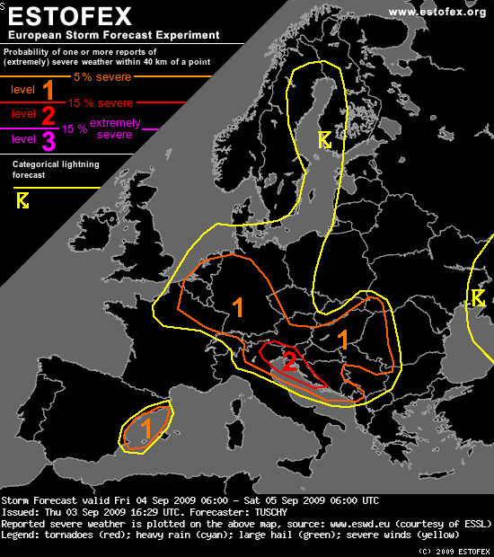
Storm Forecast
Valid: Fri 04 Sep 2009 06:00 to Sat 05 Sep 2009 06:00 UTC
Issued: Thu 03 Sep 2009 16:29
Forecaster: TUSCHY
...
A level 1 was issued for parts of Germany, Netherlands, Belgium, Luxembourg and Switzerland, parts of Austria, Hungary, E-Slovakia, W-Ukraine, W-Romania and most parts of the Balkans mainly for large hail and severe wind gusts.
...
SYNOPSIS
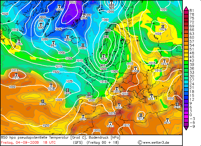
A strong upper trough over the North Sea moves eastwards and is placed over Sweden and Norway during the end of the forecast. Embedded disturbances cause unsettled conditions for most parts of central and northern Europe. Warm and stable conditions prevail over most parts of the Mediterranean and eastern Europe.
...
DISCUSSION
... Belgium, the Netherlands, Luxembourg, eastern France and Germany ...
The main story during the forecast is the passage of the trough axis and attendant pool of cold mid-level air and the passage of a wave at lower levels (in high gear below 3km). Both features are displaced in time by a few hours, so thunderstorms are forecast in numerous waves and at different places.
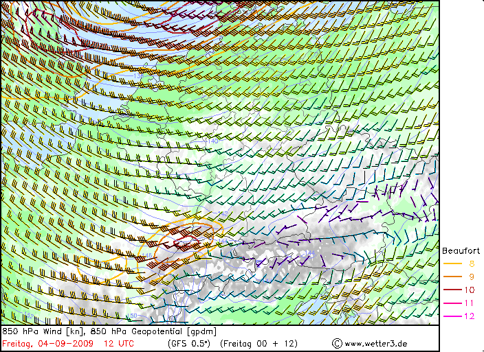
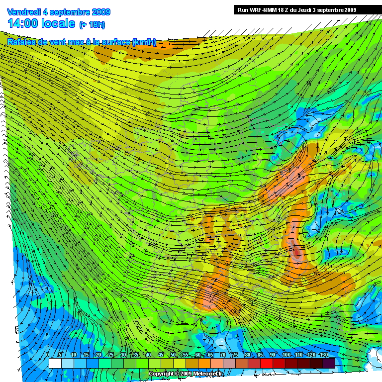
The wave is placed over eastern France (roughly 9 UTC), over southern Germany at 12-15 UTC and over the Czech Republic at 18 UTC (based on GFS with ECMWF a tad slower). Both models show potential for thunderstorms, probably deep with cool EML temperatures in GFS. Initiation will be probably bound to the eastward moving cold front with isolated showers/thunderstorms in the weakly capped prefrontal warm sector. A potential scenario is an active, eastward racing cold front with embedded thunderstorms. Degree of shear especially at low levels points to an organized line (LEWP) with a severe wind gust threat. This line ought to decrease in intensity over N-Austria and the Czech Republic during the late evening hours, as CAPE decreases. Timing of this wave is important in respect of how unstable the airmass will be, which finally affects the magnitude of the wind gust risk. Next to that dominant risk, isolated tornadoes and marginal hail can't be ruled out, given degree of shear and some LL CAPE release.
Another area of interst includes Belgium, the Netherlands, Luxembourg and most parts of Germany during the daytime hours. As cold mid-levels overspread those areas from the west, steep lapse rates and adequate surface moisture result in at least modest CAPE release (up to 500 J/kg MLCAPE). Shear decreases gradually to the north, but remains supportive for organized thunderstorms with a hail and wind gust risk. An isolated tornado risk is present due to some directional shear and low LCLs, but the overall risk remains low as directional shear component first increases as CAPE decreases (evening and night hours). Thunderstorms decay after sunset.
Quelle:
http://estofex.org/cgi-bin/polygon/show ... recast.xml
Bin sehr gespannt wann es morgen interessanter wird, am Mittag/frühen Nachmittag den Durchgang der Welle oder etwas später im Trogbereich mit der Höhenkaltluft.

Gruss Benni