Estofex hat in seinem Outlook ein großflächiges Level1 quer über Frankreich, Benelux und NW-Deutschland. Für die Nacht auf Dienstag besteht sogar ein leichtes Gewitterrisiko im Dreiländereck

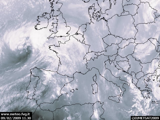
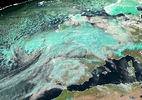
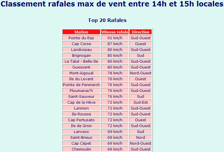
Estofex** An intense and potential life threatening extratropical storm affects parts of France during the forecast period with damaging wind gusts. However, no long-lived/organized convection is expected during the passage of the strongest wind field at roughly 21Z onwards over W-central France. A broad, low threat level was issued, which does not reflect the non-convective wind gusts threat! Please refer to your national meteorological service for more detailed informations about the intense depression. **
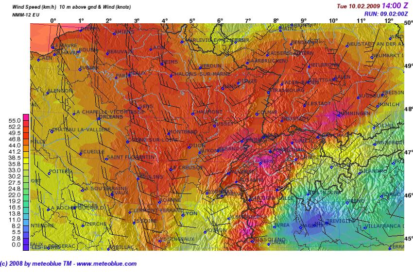
A rapidly strengthening depression approaches the English Channel from the west at 18Z. GEM is still the outlier with the weakest solution while the rest now is centered around a depression, peaking out at around 970-975hPa over the W-English Channel. The depression starts its occlusion process already during the late evening hours, as the cold front approaches NW /W-France but a constricting warm sector should persist all the way to Belgium. The connection to a subtropical airmass west of Portugal truncates as the depression approaches NW France, so the warm sector over France constantly loses its warm/moist quality betimes, which is important regarding the instability release along the cold front later-on. The positive tilt of this feature at mid-levels also keeps the atmosphere quite warm with mid-level lapse rates barely outrun 6K/km. Despite all those obstructive reasons, we still expect an active cold front passage, starting at around 18Z over NW/W France and reaching Belgium after midnight. A strong surge of dry low-stratosphere air spreads eastnortheastwards above the NE-ward moving cold front. A strong vorticity lobe also overtakes the cold front and we think that the stage is set for enhanced convective activity along the cold front. A solid line of showers/thunderstorms, possibly evolving into a LEWP, accompanies the front with the most active part likely evolving over the northrn parts of France and Belgium where forcing will be the best. The line weakens over central and east-central France during the night but re-activation over W-Switzerland and the Vosges during the morning hours is possible due to the topography and better LL moisture with a very isolated/short-lived thunderstorm risk. Winds at 850hPa rapidly increase to 30m/s along the cold front, so severe wind gusts are likely during its passage. LCLs of at or below 600m and LL shear up to 20m/s are present along the front and a QLCS-type spinup can't be ruled out, especially over far N-France, where some low-end 0-3km CAPE release is possible.
It looks like a sting jet event sets up over NW-/W-France at 21Z onwards, as an impressive 45m/s jet at 850hPa comes ashore. Widespread damaging wind gusts will occur, but deep convection is not likely in this rapidly descending branch of dry air and hence we don't reflect the serious wind threat in our final level decision.
The final area of thunderstorm chances will be just next to the depression's center, where deep convection is likely. The environment remains favorable to an isolated tornado event along the N-coast of France after midnight but the main hazard will be strong wind gusts and marginal hail.
A general thunderstorm area was not issued for the cold front, as lightning activity, if any, will be sparse. Hence just the track of the depression was included into this area. The same for W-Switzerland and the Vosges.
Gruss Benni