Werbung

Gewitter 19.07.2012

Alles zu (Un)wetter relevant für die Schweiz
Benutzeravatar
Alfred
Beiträge: 10469
Registriert: Mo 21. Jul 2003, 16:23
Geschlecht: männlich
Wohnort: 8037 Zürich
Hat sich bedankt: 49 Mal
Danksagung erhalten: 90 Mal

Gewitter 19.07.2012

Beitrag von Alfred »

oder sollte man da noch ein Fragezeichen setzen?

Sali zäme

Ich beziehe mich mal auf den Alpennordhang
Um 05:15 UTC, war es eben da, noch sehr trocken.
Bild
Aber von Nord her könnte sich das ändern, aber wie schnell?
Trifft das dann auch auf das Schweizer Mittelland zu, oder
müssen wir zu den Nachbarn (nördlich & östlich von uns) schauen?

Gruss, Alfred

Benutzeravatar
Vortex2
Beiträge: 478
Registriert: Do 18. Aug 2011, 13:51
Geschlecht: männlich
Wohnort: 8404 Winterthur / 8335 Hittnau
Hat sich bedankt: 575 Mal
Danksagung erhalten: 683 Mal

Re: Gewitter 19.07.2012

Beitrag von Vortex2 »

Sali zäme

Es ist so ruhig hier im Forum. Sind schon alle in den Ferien oder greift eine (Vor)herbstliche Depression um sich? ;)

Gemäss dem Forecast von Estofex könnte heute einiges drin liegen:
Bild

Storm Forecast
Valid: Thu 19 Jul 2012 06:00 to Fri 20 Jul 2012 06:00 UTC
Issued: Thu 19 Jul 2012 08:18
Forecaster: GATZEN

A level 2 was issued for the Alps and Austria mainly for large hail and to a lesser extend for severe wind gusts, excessive precipitation and tornadoes.

A level 2 was issued for the Czech Republic, Slovakia, and southern Poland mainly for severe wind gusts and to a lesser extend for tornadoes and large hail.

A level 1 was issued for Germany, Poland and surroundings mainly for severe wind gusts and tornadoes.
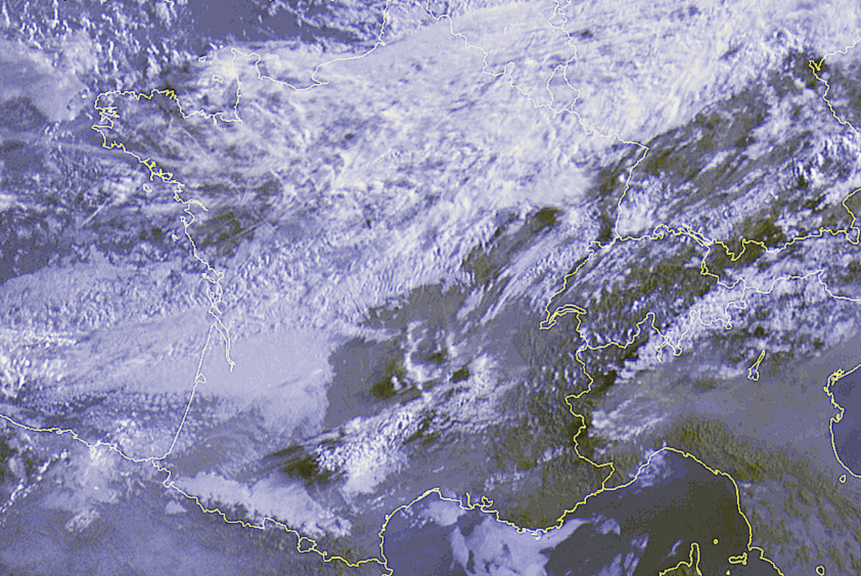
SYNOPSIS

At the southern flank of broad low geopotential across northern Europe, a strong jet streak extends from the Bay of Biscay to Germany and into western Russia today. The embedded 40 m/s mid-level speed max will race from central Germany to Belarus until the night. Quite strong QG forcing can be expected ahead of the associated short-wave trough that spreads across Germany into Poland and the Baltic States and will also affect the Alpine region.

DISCUSSION

Alpine region into southern Poland

A cold front currently crossing south-eastern Germany will enter the Czech Republic and Austria during the morning hours. Ahead of this cold front, latest soundings indicate an elevated mixed layer below 700 hPa. Low-level moisture was rather weak with low-level mixing ratios around 10 g/kg. Low-level convergence is expected together with increasing low-level moisture today. Together with diurnal heating, CAPE can rise to values near 1000 J/kg from the south Alps to Austria. Even higher values are expected by latest GFS model run across south-eastern Austria where QG forcing will also be associated with increasing lapse rates.

Current thinking is that new thunderstorms will initiate along the cold front over the Alps and the Check Republic as early as noon and will spread eastward into Austria, Slovakia, and south-eastern Poland in the afternoon hours. The strong vertical wind shear will lead to spitting storms and supercells are forecast especially from Austria to Poland where low-level winds are slightly backed leading to favourable veering low-level profiles and 0-3 km SRH around 150 m²/s². Large hail seems to be the main threat especially over south-eastern Austria, where also very large hail with isolated supercells is not ruled out. Additionally, tornadoes are not ruled out especially in the evening hours when low-level wind shear will increase. Storms may merge into an MCS in the afternoon and evening hours given the strong QG forcing capable of producing excessive precipitation and severe wind gusts.

Further north, storms are expected to merge along the cold front given strong cloud-bearing winds parallel to the boundary and increasing cold pool potential. A squall line with rapidly moving bowing segments is forecast and severe wind gusts may become more pronounced in the late afternoon and evening hours. Tornadoes may develop along the leading gust front given the large overlap of low-level vertical wind shear and CAPE. Strong tornadoes are not ruled out.

Northern and central Germany into Poland and surroundings

Strong QG forcing and strong vertical wind shear will overlap with moderate low-level moisture and weakly unstable lapse rates over a broad region that spreads eastward during the day. Showers and thunderstorms have already developed that move quickly east. Due to the strong shear, bowing segments are expected capable of producing severe wind gusts. Tornadoes are not ruled out given the broad overlap of low-level vertical wind shear and instability that seems to be best from northern Germany into Poland where the best low-level moisture will be situated during the noon and afternoon hours. Drier air masses will spread eastward behind the frontal boundary and convective activity is forecast to decay from the west.

Northern Italy

South of the Alps, a rather strong capping inversion and weak low-level moisture was indicated by latest observations. Increasing low-level moisture and daytime heating will lead to substantial CAPE in the afternoon and evening hours combined with strong deep layer vertical wind shear. Every storm that can persist within this thermodynamic profile has a large potential to organize and very large hail is not ruled out. However, current indications are weak that storms will really develop as QG forcing will be rather weak to the south of the jet.
Quelle: http://www.estofex.org

Gruess


B3rgl3r
Beiträge: 655
Registriert: Mo 12. Jul 2010, 14:40
Geschlecht: männlich
Wohnort: 7408
Hat sich bedankt: 49 Mal
Danksagung erhalten: 117 Mal

Re: Gewitter 19.07.2012

Beitrag von B3rgl3r »

Vor allem Österreich (Steiermark), tönt interessant :shock:
Viele Grüsse, Andy, GR

Sennemaa

Re: Gewitter 19.07.2012

Beitrag von Sennemaa »

Hallo

Ich sage es so, mal abwarten ich habe meine Euphorie so ziemlich ausgebremst da ich sonst nur herber enttäuscht bin wenn es nicht kommt. so wie schon oft :lol: in den letzten Jahren
Estofex sieht lecker aus muss ich schon sagen. Aber mal sehen was wirklich drin ist, spannend bleibt es auf jeden Fall. Nur Schade hat die Hitze nur ein Tag gedauert, mal sehen wie gut es aufgeheizt hat.

Gruss Sennemaa

Benutzeravatar
Phil (Dübendorf)
Moderator
Beiträge: 795
Registriert: Mo 7. Mai 2012, 17:04
Geschlecht: männlich
Wohnort: 8600 Dübendorf
Hat sich bedankt: 179 Mal
Danksagung erhalten: 35 Mal
Kontaktdaten:

Re: Gewitter 19.07.2012

Beitrag von Phil (Dübendorf) »

Ich bin hier in Ravensburg (Deutschland) und warte mal ab. Heute wirds aber wohl eher spät werden mit elektrischem, da hier vorerst nur wenig Sonne scheint. Aber mal sehen... :)

Gruss Phil
Höhe Dübendorf/ZH: 440 m ü. M.
---------------------------------------------------
Wetterstation Dübendorf: https://www.meteo-duebendorf.ch/

Benutzeravatar
pasischuan
Beiträge: 717
Registriert: Mi 1. Dez 2010, 07:03
Geschlecht: männlich
Wohnort: 3608 Thun
Hat sich bedankt: 63 Mal
Danksagung erhalten: 98 Mal

Re: Gewitter 19.07.2012

Beitrag von pasischuan »

Zur Zeit ist weder auf landi noch auf search etwas von Gewittern oder NS zu sehen. WRF hat immerhin in den Alpen Gewitter/NS drin für heute abend..
Immerhin wurde im Radio auf ein mögliches Gewitter am Abend hingewiesen..

Denke jedoch das wird auch heute wieder ein schöner ruhiger Sommerabend.. geniessen wir doch den, es gibt ja so oder so wieder viel zu wenige .. :-D

gruss pasi
Thun, Allmendingen (BE), 580 m.ü.M.

Benutzeravatar
Rontaler
Beiträge: 3277
Registriert: Do 17. Jan 2008, 18:23
Geschlecht: männlich
Wohnort: 6280 Hochdorf LU
Hat sich bedankt: 672 Mal
Danksagung erhalten: 962 Mal

Re: Gewitter 19.07.2012

Beitrag von Rontaler »

@ pasi: Gehe mit Dir einig. Gewitter heute Abend? Ich glaube eher nicht. ;)
Wetterfanatisch mit Leib und Seele. :)


Severestorms
Administrator
Beiträge: 6648
Registriert: Mo 20. Aug 2001, 17:21
Geschlecht: männlich
Wohnort: Zürich
Hat sich bedankt: 3765 Mal
Danksagung erhalten: 1660 Mal
Kontaktdaten:

Re: Gewitter 19.07.2012

Beitrag von Severestorms »

Sennemaa hat geschrieben:Hallo

Ich sage es so, mal abwarten ich habe meine Euphorie so ziemlich ausgebremst da ich sonst nur herber enttäuscht bin wenn es nicht kommt. so wie schon oft :lol: in den letzten Jahren
Estofex sieht lecker aus muss ich schon sagen. Aber mal sehen was wirklich drin ist, spannend bleibt es auf jeden Fall. Nur Schade hat die Hitze nur ein Tag gedauert, mal sehen wie gut es aufgeheizt hat.

Gruss Sennemaa
Hallo Sennemaa

Warum hast du denn so hohe Erwartungen? Estofex sieht vor allem für Österreich "lecker" aus. Man darf die Linien nicht allzu genau nehmen; muss es immer auch im Kontext sehen. Gewitter wird es heute Nachmittag und Abend vermutlich hauptsächlich in den Ostalpen (und später im Tessin) geben. Aber diese könnten wegen der Scherung vereinzelt recht kräftig ausfallen.

Es hat übrigens bereits ausgelöst oberen Rheintal. Früher als Cosmo es haben wollte.

Gruss Chris
Zuletzt geändert von Severestorms am Do 19. Jul 2012, 14:09, insgesamt 1-mal geändert.
Founder, Owner and Operator of SSWD - Engaged in Science & Research since 1997.
Follow @SturmarchivCH on Twitter to get accurate information about severe, extreme or unusual weather events in Switzerland - fast and reliable.

Thomas - Sargans
Beiträge: 59
Registriert: Mo 23. Nov 2009, 10:33
Danksagung erhalten: 9 Mal

Re: Gewitter 19.07.2012

Beitrag von Thomas - Sargans »

@ Christian

Yep, kann ich bestätigen
Hier in Haag ein kurzer kräftiger Schauer mit Blitz und Donner.
Hat aber schlimmer ausgesehen als es gekommen ist.

Gruess Thomas

PS: was mir völlig unklar ist woher der prognostizierte stürmische SW-Wind kommen soll.
Zuletzt geändert von Thomas - Sargans am Do 19. Jul 2012, 14:54, insgesamt 2-mal geändert.

Jan (Böckten, BL)
Beiträge: 1038
Registriert: Mo 13. Okt 2003, 10:22
Wohnort: Böckten BL
Hat sich bedankt: 40 Mal
Danksagung erhalten: 206 Mal

Re: Gewitter 19.07.2012

Beitrag von Jan (Böckten, BL) »

In Basel klassischer NW-Wind Durchbruch mit Böen um 50km/h und Stabilisierung. Es hat bereits auf 20.8 Grad abgekühlt und somit ist die Energie gewittermässig draussen. Estofex hätte den Jura heute wohl gewittermässig auch ausklammern können, bei solchen Lagen kühlt's hier immer sehr schnell ab (nördlich des Jura aktuell bereits nur 17-21 Grad, im Mittelland und weiter südlich derzeit noch 24 bis 27 Grad).

Antworten