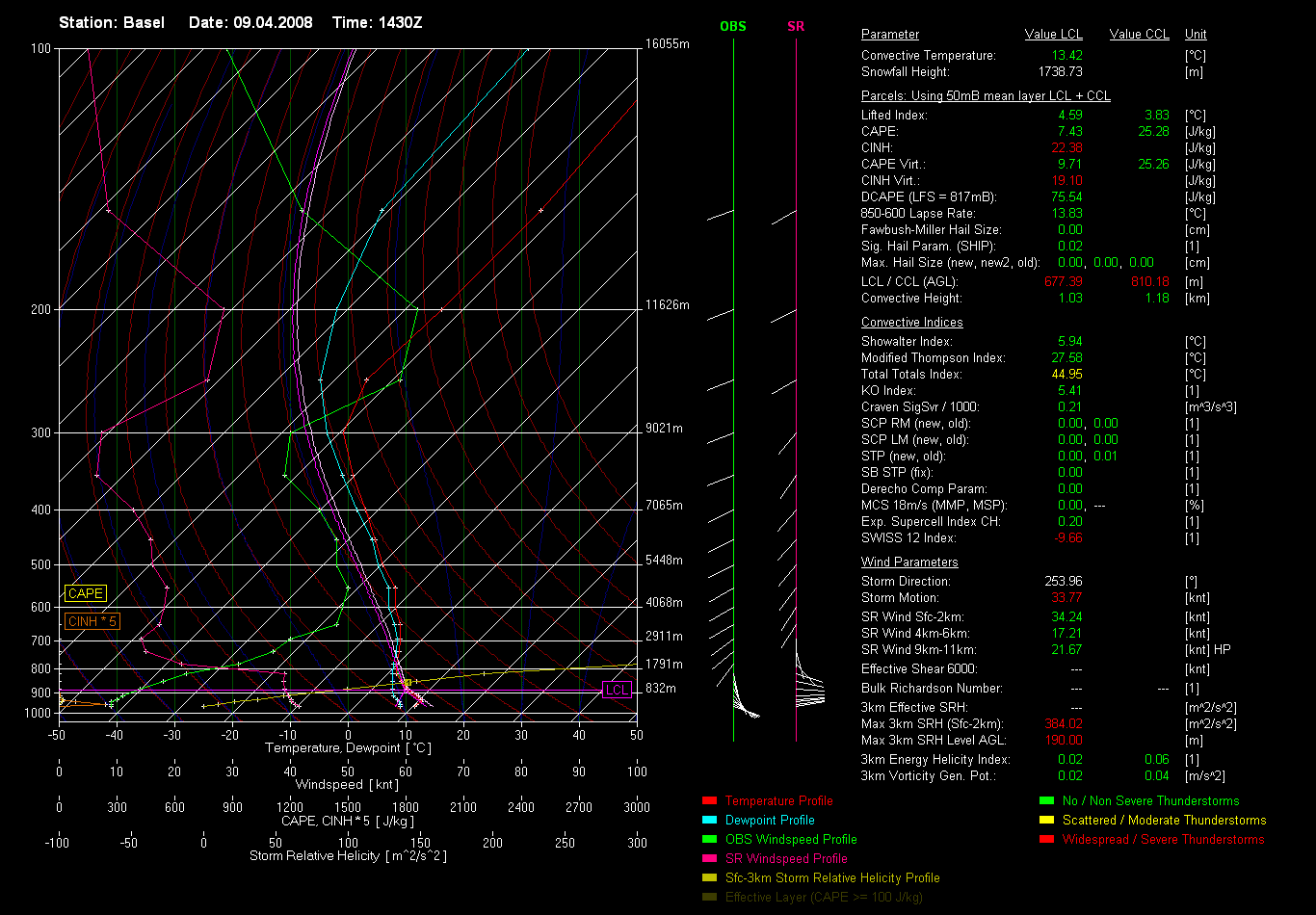
jup, das sieht interessant aus westl. des Juras. Ziemlich klassisch
http://www.sat24.com/images.php?country ... 7749370473
Ob es aber bis in die Schweiz ziehen wird, bleibt noch abzuwarten...
Gruss, Thies
In Zusammenarbeit mit meteoradar

Werbung
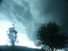

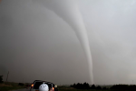


Isolated thudnerstorms storms have formed in a highly h moving into the area. Radar indicates a few mini-supercell-like structures, that may bring some large hail, and severe winds locally. An isolated tornado cannot be fully ruled out either. The convective activity should gradually weaken during the late evening and overnight.

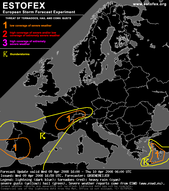
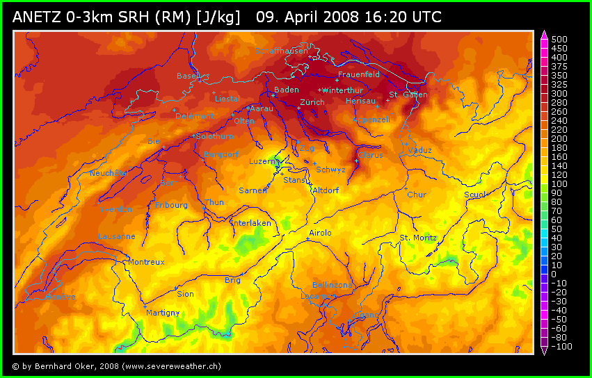
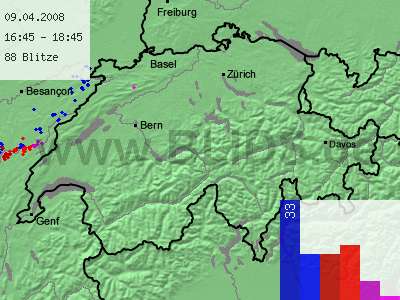
Quelle: EstofexE France, W Switzerland, extreme SW Germany...
Isolated thudnerstorms storms have formed in a highly h moving into the area. Radar indicates a few mini-supercell-like structures, that may bring some large hail, and severe winds locally. An isolated tornado cannot be fully ruled out either. The convective activity should gradually weaken during the late evening and overnight.
Werbung