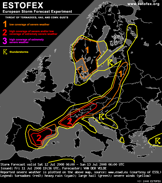
Für morgen Sonntag sollen vor allem in NE-Italien gute Chancen für schwere Gewitter mit Tornados und grossem Hagel bestehen (siehe auch Estofex Vorhersage).
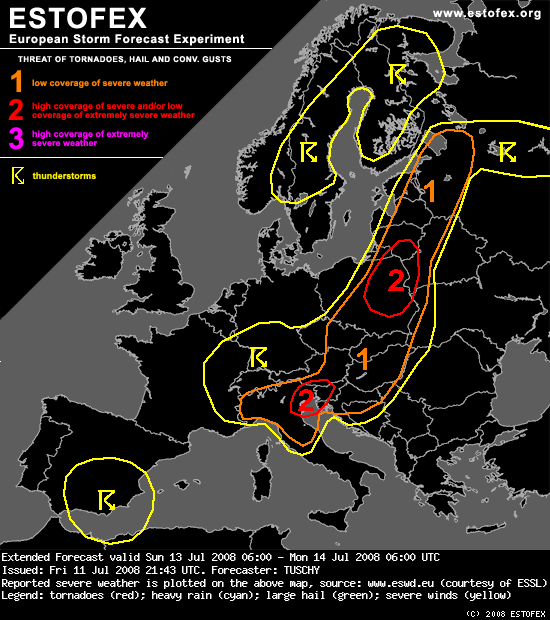
... N - Italy, parts of Austria, Slovenia, Hungary, Slovakia, Poland, Lithuania, Latvia, Estonia and western Belarus and Ukraine ...
Downstream of the major trough, numerous disturbances come out of the base in a strong SW - erly upper - level flow. A combination of a slowly eastward moving surface cold front and aforementioned disturbances atop of that front result in a broad area with enhanced thunderstorm chances. Strong moisture influx just ahead of the front will help to boost instability values well above 1000 J/kg MLCAPE as mid - level lapse rates stay very steep. The same for NE Italy and Slovenia.
The final degree of severity depends both on the upper disturbances and possible numerous surface depressions, which both support a significantly veered / backed wind field at mid / lower levels. The past few GFS runs already had an environment favorable for supercells with a tornado, very large hail and severe wind gust risk, running from Poland northeastwards. Confidence is high enough to go with a level -2 area although this is yet a coarse one that far out. Some modifications may be needed in the Day - 1 outlook, e.g. a NE - ward expansion due to an augmented tornado risk.
Another level - 2 was issued for parts of NE - Italy and W - Slovenia, where strong instability release, 20 m/s DLS and enhanced SRH values overlap with significant hail being a distinct possibility. This level - 2 may have to be expanded well to the E / NE due to an enhanced very large hail risk, but we want to wait for more informations ( e.g. new model runs ) before doing so, especially as the DLS stays quite weak with 10 - 15 m/s DLS.
Betimes, numerous thunderstorm clusters will evolve in the broad level areas with an enhanced flash flood risk.
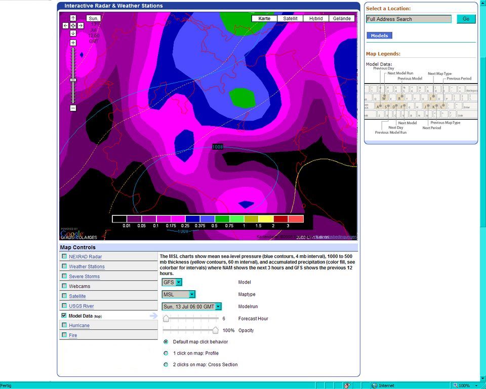
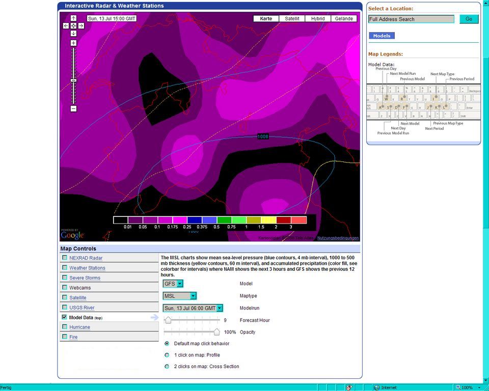
Wir (Oneil, Andreas und ich) werden voraussichtlich gegen Mittag in Chiasso sein und dort erst mal den Labby anschmeissen, bevor wir nach Italien vorstossen. Unser primäres Ziel wird aber nicht der Raum Venetien sein (soweit wollen wir nicht fahren), sondern erstmal die Lombardei. Die Modelle deuten zum späteren Nachmittag und Abend hin zellulare Konvektivität an:
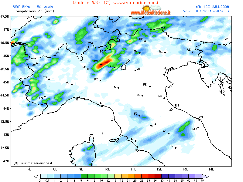
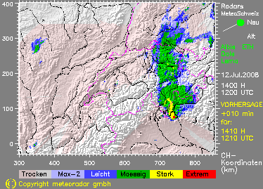
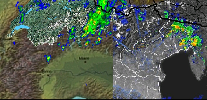
Die bis in die späten Morgenstunden andauernden Starkniederschläge auf der Alpensüdseite machen mir allerdings noch etwas Sorgen. Ich fürchte, dass sie eine optimale Sonneneinstrahlung verhindern könnten.
Geht eigentlich noch jemand anderer nach Norditalien chasen? Falls ja, meine Nummer habt ihr ja (siehe meine Homepage). Kontaktaufnahme wenn möglich bis spätestens 11 Uhr, da wir dann mit hoher Wahrscheinlichkeit noch in der Schweiz sind (wegen teurem Roaming)..
Gruss Chrigi