Werbung

Forecasting: Grossraumchasing Ost-F/West-CH/Nord-I vom 11.07.2008 - 14.07.2008

Alles zu (Un)wetter relevant für die Schweiz
Benutzeravatar
Alfred
Beiträge: 10469
Registriert: Mo 21. Jul 2003, 16:23
Geschlecht: männlich
Wohnort: 8037 Zürich
Hat sich bedankt: 49 Mal
Danksagung erhalten: 90 Mal

Forecasting: Grossraumchasing Ost-F/West-CH/Nord-I vom 11.07.2008 - 14.07.2008

Beitrag von Alfred »

Sali mitenand

Ich habe doch auch gleich Bernhards subtiles Wölklein mit der
Gundschicht festgehalten, denn am morgigen Tag wird es ja wohl
nur noch mehr oder weniger grosse Kleckse geben!
Bild
(MET9 13:00 UTC)

Gruss, Alfred
[hr]

Pät, Basel
Beiträge: 431
Registriert: Di 18. Jun 2002, 09:35
Geschlecht: männlich
Wohnort: 4105 Biel-Benken BL
Hat sich bedankt: 7 Mal
Danksagung erhalten: 69 Mal

Forecasting: Grossraumchasing Ost-F/West-CH/Nord-I vom 11.07.2008 - 14.07.2008

Beitrag von Pät, Basel »

hoffen wir jedoch, dass dieses nächtliche gewölk dann am FR morgen schnell wieder abzieht... timing scheint für einmal wirklich hinzuhauen für jura/nordwest-schweiz ;-)


Benutzeravatar
Thies (Wiesental)
Beiträge: 1818
Registriert: Fr 17. Aug 2001, 07:29
Wohnort: 79688 Hausen im Wiesental (D)
Hat sich bedankt: 148 Mal
Danksagung erhalten: 95 Mal

Forecasting: Grossraumchasing Ost-F/West-CH/Nord-I vom 11.07.2008 - 14.07.2008

Beitrag von Thies (Wiesental) »

Hallo zusammen,

wirklich spannend. Ich kann mir auch vorstellen, dass im Rahmen des bei Sat24 bereits deutlich sichtbaren Feuchtefeldes noch die ein oder andere stärkere Auslöse stattfinden wird. Mit etwas Glück tangiert diese Entwicklung dann am späten Abend noch den westlichen Jura oder die Vogesen.

Nach einer kurzen Beruhigung könnte das Timing morgen auch aus meiner Sicht günstig sein. Aber was speziell die Region Basel betrifft, möchte ich etwas auf die Euphoriebremse drücken. Am Vormittag sehen die Bedingungen definitiv gut aus. Aufheizen erscheint möglich, Labilitätsaufbau ebenfalls. Und dann kommt die Hebung. Eigentlich würde alles passen, doch GFS simuliert ab den Mittagsstunden West und am Nachmittag bereits tendenziell nordwestliche Bodenwinde. Während in der restlichen Schweiz, am Oberrhein sowie östlich davon alles für einzelne starke Gewitter spricht, könnte der NW-Wind die Gewitter rund um Basel vergeigen... aber ich täusche mich gerne. Das sind reine Erfahrungswerte. Ich bin gespannt, was rund um Basel passieren wird, sollte der Wind tatsächlich frühzeitig auf W/NW drehen.

Gruss, Thies
Thies Stillahn (Gewitterjagd im Dreiländereck D/CH/F)

Marco (Bettlach)

Forecasting: Grossraumchasing Ost-F/West-CH/Nord-I vom 11.07.2008 - 14.07.2008

Beitrag von Marco (Bettlach) »

Brandheiss und topaktuell - soeben erschienen:
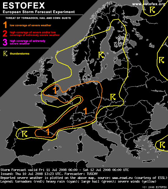
Bild


DISCUSSION

... Germany, Belgium and the Netherlands ...

Despite high confidence in widespread nature of thunderstorm coverage, degree of organisation and kind of storm mode are somewhat diffuse. The main issue is a weakly positive tilted upper trough approaching from the west resulting in a sharp temperature gradient at all levels on its downstream side. A distinct focus for initiation is quite difficult to determine as various small disturbances are embedded in this strong SW - erly flow. A mixture of a slowly eastward propagating surface cold front, aforementioned disturbances and the trough axis itself should support scattered to widespread initiation, assisted by a overall weakly capped environment.

The thermodynamics are favorable for intense updraft evolutions in a swath, running from SW Germany to NE Germany, as a moist BL and steep mid - level lapse rates overlap. Instability values decrease markedly over NW Germany, Belgium and the Netherlands... at least until the evening hours as mid - / upper cold pool slides in from the west.

DLS is quite strong with 15 - 20m/s over SW / E and NE Germany, increasing significantly to more than 30 m/s over NW Germany. The decline of the speed maxima at different levels is very strong with 25m/s 700 hPa speed max over central Germany and a 40 m/s 500 hPa speed max over NW Germany all during the afternoon hours. At lower levels ( e.g. 850 hPa ), a broad 10 - 15 m/s jet overspreads the area with no real speed maximum in evidence. As those small disturbances rotate northeastwards, veering becomes locally more distinct with numerous SRH maxima, changing from run to run.

To combine all those jigsaw pieces comes along with an augmented degree of uncertainty. Final placement of the surface cold front also depends on how active the front was the night before, but at the moment we think that a swath along this slowly east / northeastward moving cold front will see the most concentrated area of severe weather, running from SW - Germany to E / NE Germany. Near parallel alignement to the background flow and weak capping should support early and scattered initiation with rapid clustering. Mainly during the early stage, when storms stay more discrete, there will be a distinct large hail and strong to severe wind gust threat, but betimes, storms will grow upscale into a few clusters. The highest large hail risk should be confined to S and E - Germany, changing to a wind threat over NE - Germany as 700 hPa speed max approaches. The only consistent signal during the past few model runs was an increase in thunderstorm coverage during the evening hours over SW Germany due to the approaching trough axis and we think that a cluster of storms will develop, moving northeastwards, although we would not be surprised to see an eastward shift of its track during the next few model runs . Low LCLs and locally enhanced LL shear along the front could also support an isolated tornado report although the risk should switch over to a local flash flood risk especially as storms cluster.

Less instability and warm ELs make the severe risk over NW Germany and the Netherlands during the late morning and midday hours more conditional. Latest model outputs of GFS had a more favorable environment from run to run with stronger instability release. We expanded the level area well to the NW as each updraft, penetrating deeper in the atmosphere cashes in on intense shear, resulting in an isolated large hail, strong to severe wind gust ( especially if storms bow out ) and isolated tornado threat.

Finally the risk of thunderstorm increases again during the late afternoon and evening hours over NW Germany, Belgium, the Netherlands and extreme NE France as mid - levels finally cool down and the upper trough axis approaches from the west. Deep convection is possible and as DLS remains strong and LL shear increases during the evening hours the risk of an isolated tornado / large hail report over those areas will be present.

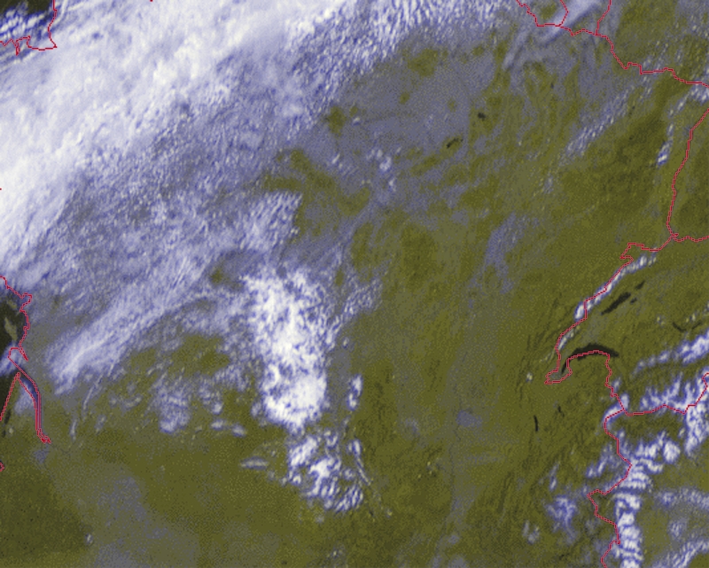
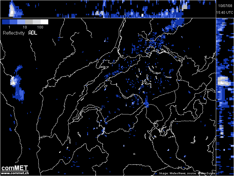
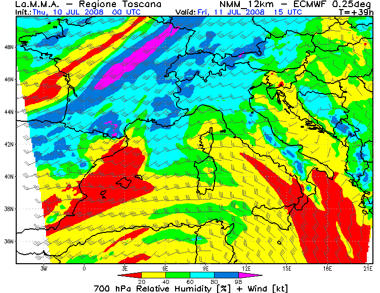
... SE / S - France and Switzerland ...

MLCAPE values between 500 and more than 1000 J/kg will be present as DLS increases from the west to about 20 m/s. As surface front creeps in from the WNW, thunderstorms will go on / re - develop already during the morning hours. Shear and instability will be fine for large hail and strong to severe wind gusts, especially if more discrete storms can evolve ahead of this front. In addition, complex topography and already enhanced LL shear could result in a tornado report. Betimes, storms will grow upscale into a large storm cluster with an excessive rain risk.


... N - Italy and most parts of Austria ...

Moderately sheared atmosphere and about 1000 J/kg will be present and widespread thunderstorms will evolve as the lifting mechanisms approach from the west. A few large hail reports can be expected and hence the level - 1 area was expanded well towards the east.

... SE - UK ...

A strong convergence zone is forecast to cross the area during the peak heating hours from the NW. Airmass will be quite unstable with MLCAPE values of up to 500 J/kg ahead of this zone. GFS has signals of a strong amount of LL CAPE release as diabatic heating and CAA at mid - levels overlap. LCLs stay low and hence we issued a level - 1 for numerous funnel and tornado reports which could evolve along this SE - ward moving convergence zone.


Interessant beim fetten Teil ist der Teil mit Tornadoreports in Bezug auf die Topografie. Wir werden's sehen.

Benutzeravatar
Silas
Beiträge: 2220
Registriert: Di 29. Mär 2005, 19:10
Geschlecht: männlich
Hat sich bedankt: 11 Mal
Danksagung erhalten: 133 Mal
Kontaktdaten:

Forecasting: Grossraumchasing Ost-F/West-CH/Nord-I vom 11.07.2008 - 14.07.2008

Beitrag von Silas »

Hallo zäme
Vorhin habe ich einige Vorhersagesoundings angeschaut. Falls ich die nicht falsch interpretiere, scheint es morgen deutlich weniger labil zu sein als heute. Die Troposphäre wäre zwar bis ca. 5000m deutlich labil geschichtet, darüber aber gar wieder stabil. Wie lässt sich erklären, dass Morgen das Gewitterrisiko doch deutlich höher ist, als heute?
Gruss Silas
Wetterstation Oberthal 850 m.ü.M.: http://silas.emmewetter.ch

Benutzeravatar
Badnerland
Beiträge: 1655
Registriert: Di 9. Mai 2006, 20:38
Geschlecht: männlich
Wohnort: D - 79104 Freiburg im Breisgau
Hat sich bedankt: 291 Mal
Danksagung erhalten: 231 Mal

Forecasting: Grossraumchasing Ost-F/West-CH/Nord-I vom 11.07.2008 - 14.07.2008

Beitrag von Badnerland »

In diesem Feuchtefeld über Frankreich (s.o.) hat sich nun auch eine erste Zelle entwickelt (taucht gerade auf dem Landi-/Meteoradar auf). Bin ja mal gespannt, ob es heute noch Blitze zu sehen gibt oder ob sich alles noch über Frankreich abspielt. Könnte auch in Bezug auf morgen den ganzen Plan durcheinanderwirbeln (Wolkenreste -> verminderte Sonneneinstrahlung oder aber auch Niederschläge -> mehr Bodenfeuchte etc.pp.).

Gruss Benni
meist rund um Freiburg oder der Umgebung (Oberrheingraben, Schwarzwald, Dreiländereck) unterwegs ;-)

Benutzeravatar
Michi, Uster, 455 m
Beiträge: 2776
Registriert: Fr 17. Aug 2001, 21:34
Geschlecht: männlich
Wohnort: 8610 Uster
Danksagung erhalten: 281 Mal

Forecasting: Grossraumchasing Ost-F/West-CH/Nord-I vom 11.07.2008 - 14.07.2008

Beitrag von Michi, Uster, 455 m »

Die Zelle zielt momentan Richtung Vogesen und hat doch immerhin schon hohe Intensität erreicht:
Bild


Benutzeravatar
Cyrill
Beiträge: 2733
Registriert: Do 27. Mär 2008, 07:01
Geschlecht: männlich
Wohnort: 6215 Beromünster
Hat sich bedankt: 2073 Mal
Danksagung erhalten: 1682 Mal
Kontaktdaten:

Forecasting: Grossraumchasing Ost-F/West-CH/Nord-I vom 11.07.2008 - 14.07.2008

Beitrag von Cyrill »

@ Tinu (Männedorf)
Vielleicht war meine Beurteilung etwas zu hoch gegriffen. Wie befürchtet hat sich das Tief etwas abgeschwächt und scheint nun in Richtung Skandinavien unterwegs zu sein. Bleibt nun zu hoffen, dass das von Dir beschriebene Randtief an Einfluss gewinnt (Alarmstimmung bei den Meteorologen). Die Vorhersage für unsere Region von Estofex (...and strong to severe wind gusts) scheint mir dennoch bemerkenswert.....
Lieber Gruss Cyrill

nordspot
Beiträge: 2328
Registriert: So 18. Mär 2007, 16:32
Geschlecht: männlich
Wohnort: D-78464 Konstanz
Hat sich bedankt: 835 Mal
Danksagung erhalten: 295 Mal
Kontaktdaten:

Forecasting: Grossraumchasing Ost-F/West-CH/Nord-I vom 11.07.2008 - 14.07.2008

Beitrag von nordspot »

Hoi! Ziemlich schnell unterwegs nach osten ist das Gewitter in Frankreich, oder irre ich mich da?
Grüße
Ralph
nordspot Konstanz

Benutzeravatar
knight
Moderator
Beiträge: 1366
Registriert: Fr 29. Jul 2005, 21:58
Geschlecht: männlich
Wohnort: 1786 Sugiez
Hat sich bedankt: 984 Mal
Danksagung erhalten: 473 Mal
Kontaktdaten:

Forecasting: Grossraumchasing Ost-F/West-CH/Nord-I vom 11.07.2008 - 14.07.2008

Beitrag von knight »

@ nordspot

Auf alle Fälle ist das ein Vorgeschmack für das Chasing von morgen...
Das Motto wird lauten: Die richtige Position einnehmen und geniessen! Mit fast über 30 Knoten kommen die Zellen angerauscht!

Bild

Ich werde jetzt noch die Abendsonne geniessen bevor ich mich hinter das Kartenmaterial setzten werde...

Liebe Grüsse
Dominic
Sugiez - Mont Vully - Seeland

Antworten