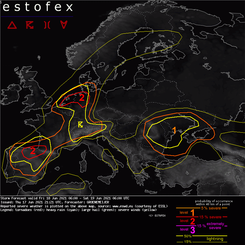
Morgen dürfte es mit den ersten beiden Punkten etwas besser aussehen. Für die NW-Schweiz hat Estofex ein Level 2 drin:
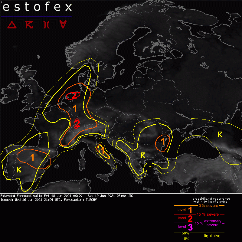
Quelle: estofex.org...
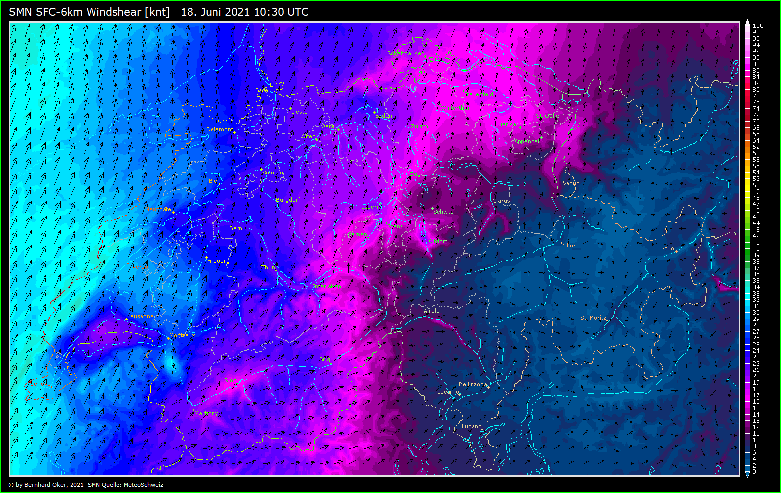
Luxembourg to Switzerland into SW Germany ... The latest idea is that initiating convection along the Jura/Vosges Mountains into Switzerland evolves into organized multicells/a few supercells due to 10-15 m/s DLS and regionally enhanced (by orography) 0-3 km directional shear (especially for right moving cells) with (very) large hail, severe wind gusts and excessive rain. With LCLs lowering to 600-900 m during the late afternoon hours a tornado threat may accompany strongest storms over E-France into W-Switzerland. This activity spreads E/NE with upscale growth into numerous large clusters. Moving into a deep/well mixed low-tropospheric air mass over SW Germany, cold pool driven severe wind gusts/large hail become an issue, next to excessive rain with cell mergers/during upscale growth. Betimes this activity outruns best forcing with increasing CIN, so a decrease in coverage/intensity over CNTRL/S Germany is anticipated. Dependant on the degree of organization of the individual clusters, the eastern fringe of the level 1 may see an adjustement to the E/NE in later outlooks.
...
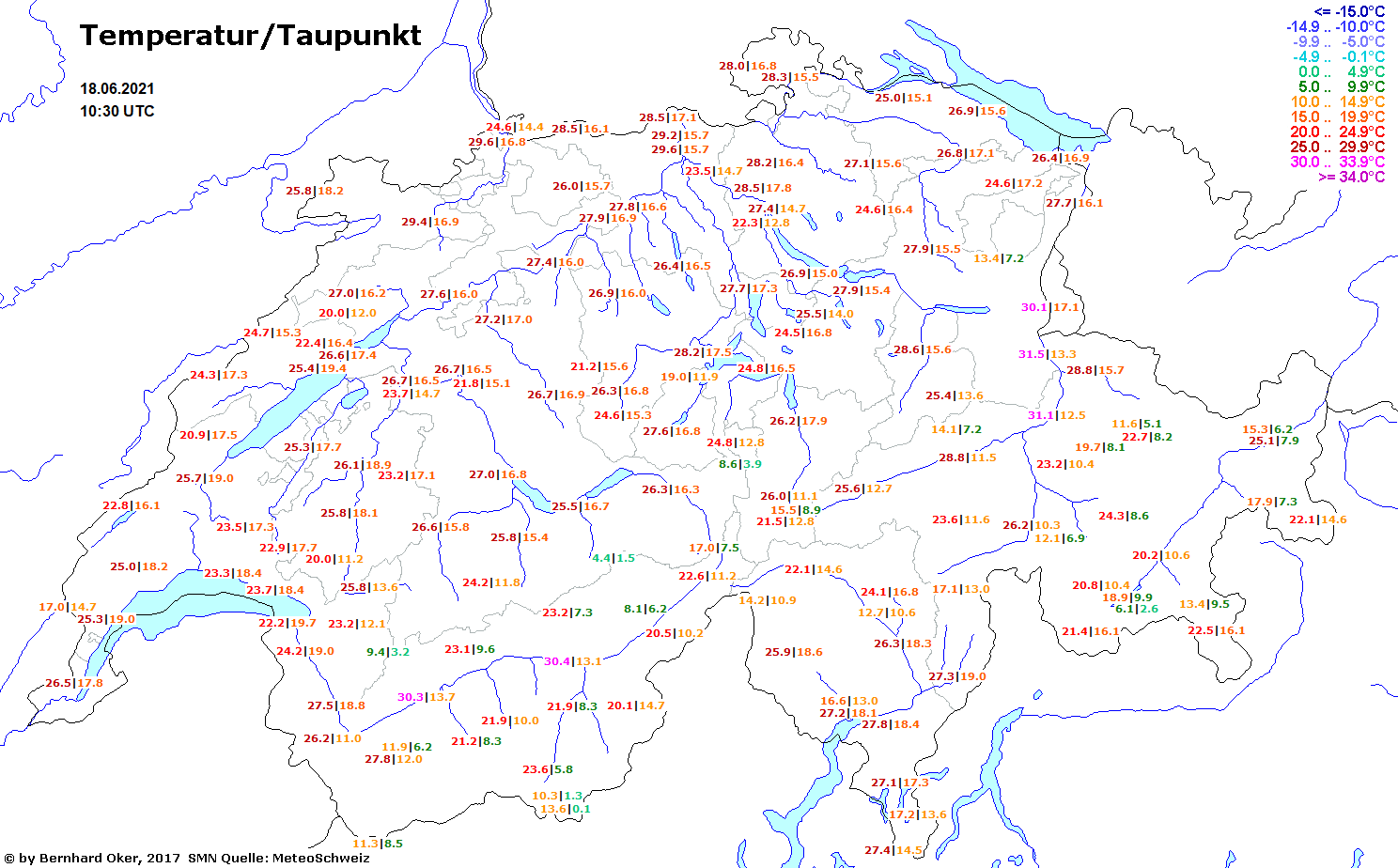
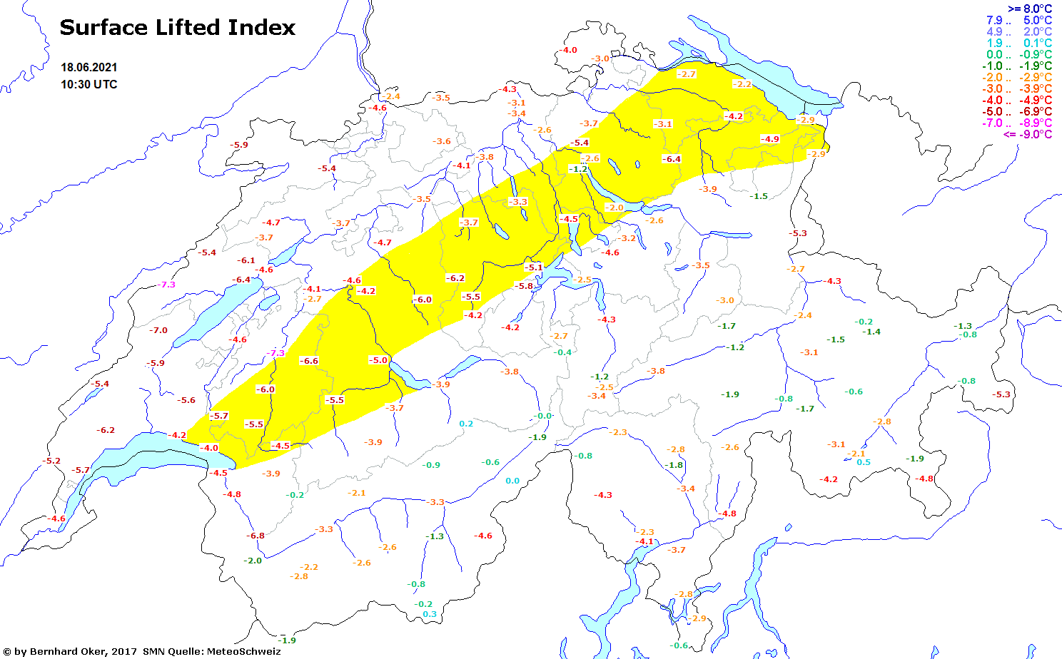
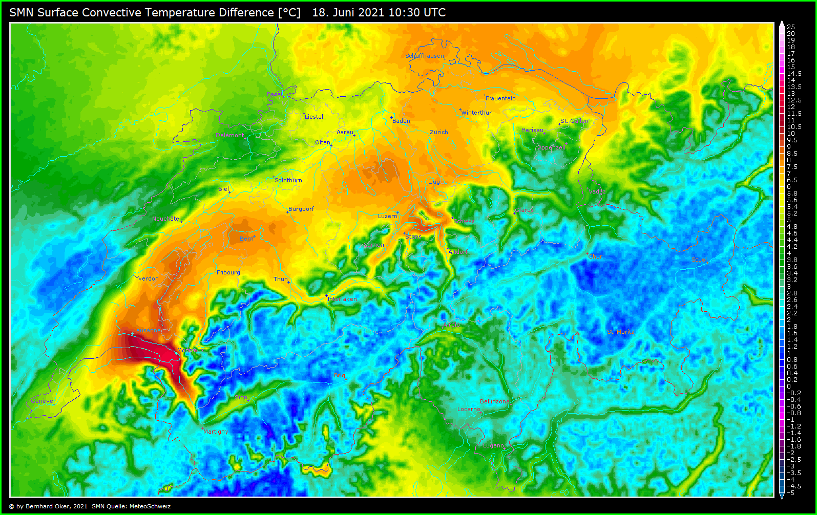
Der Sonntag sieht weiterhin gefährlich bzw. nach einer Unwetterlage aus, weil dynamische Hebung und zünftig Scherung gerechnet werden.
Gruss Chris