Ich eröffne einmal einen neuen Thread für Heute.
Estofex hat Heute für die östlichen Schweizer Alpen erneut einen Level 2, weiter im Osten in Österreich sowie in Italien einen Level 3:
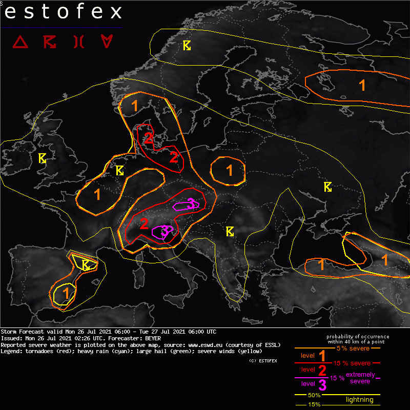
Quelle: estofex.org... Greater Alpine region ...
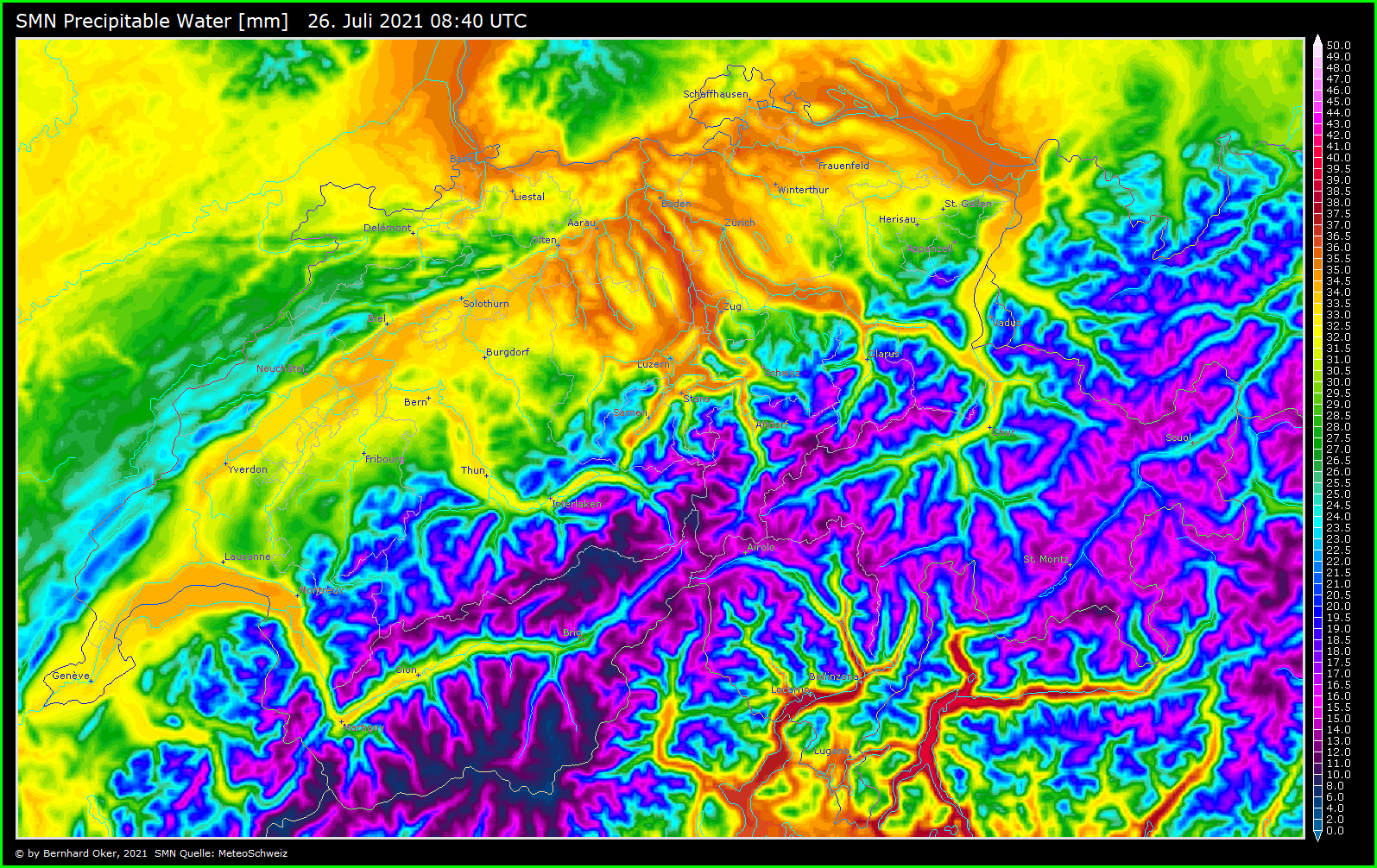
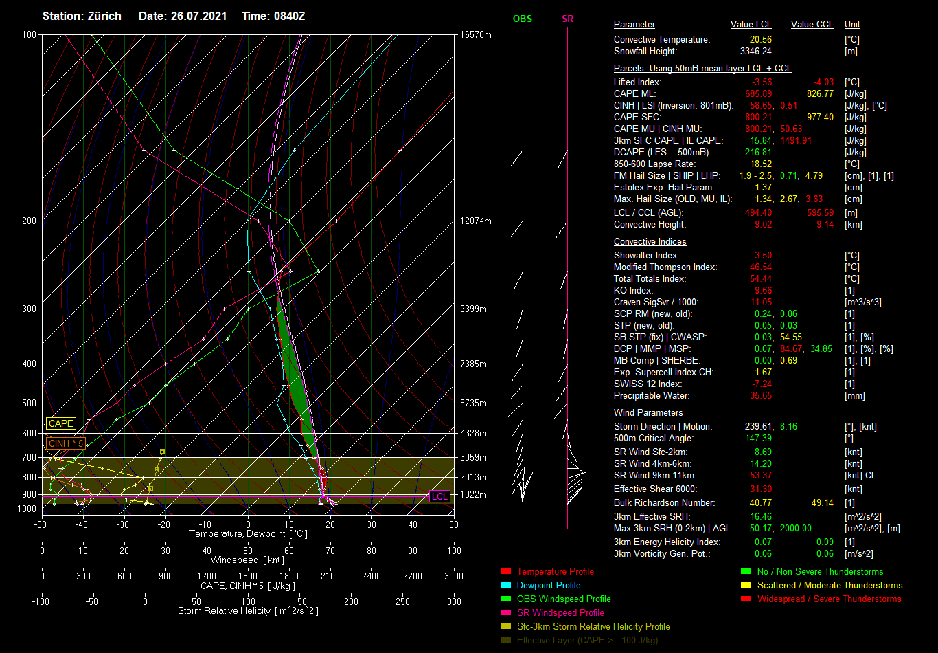
Ahead of the diffuse and almost stationary cold front, a plume of steep lapse rates (the remnants of an elevated mixed layer from the Sahara) are reinforced by diurnal heating over the Alps. As they overspread moist low-level air over the forelands with 2m dewpoints in the upper tens or locally lower twenties, about 500-1500 J/kg CAPE are created and overlap with moderate deep-layer shear (10-15 m/s) and veering wind profiles in the lowest layers. Even more CAPE and stronger shear are likely in N Italy, which is situated closest to the jet maximum, and more locally along the north Alpine rim in Austria, where moist NE-erly upvalley circulations undercut the SW-erly mid-level flow. In these two regions, an overlap of ~2000 J/kg CAPE and ~20 m/s deep-layer shear will likely be realized according to high-resolution forecast models.
With the help of various mid-level vorticity maxima and the rather strong SW flow storms will initiate on the leeward flank of the N Apennines and E Alps in the afternoon and evening hours. A high degree of storm organization into strong multicells and supercells is expected given the high shear values. High resolution models simulate several long-tracked supercells.
Later some of these storms may grow into a few MCSs. While at the beginning large hail and severe wind gusts are a main, clustering will enhance the possibility for excessive precipitation. Rather high mid-level shear (0-3km) also enhances the risk for bowing segments that then again pose a threat for severe wind gusts.
Isolated to scattered extreme events are foreseen, especially in the mentioned regions of best overlap of enhanced CAPE and vertical wind shear.
In the plains of N Italy, low cloud bases and locally enhanced 0-1 km shear also point to a possibility of one or two tornadoes.
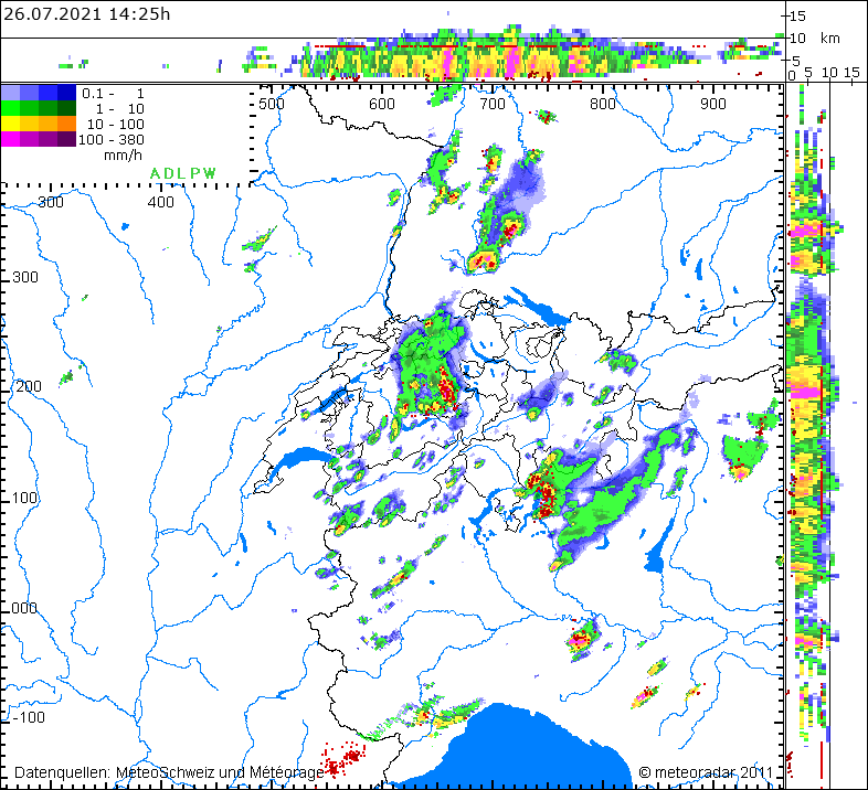
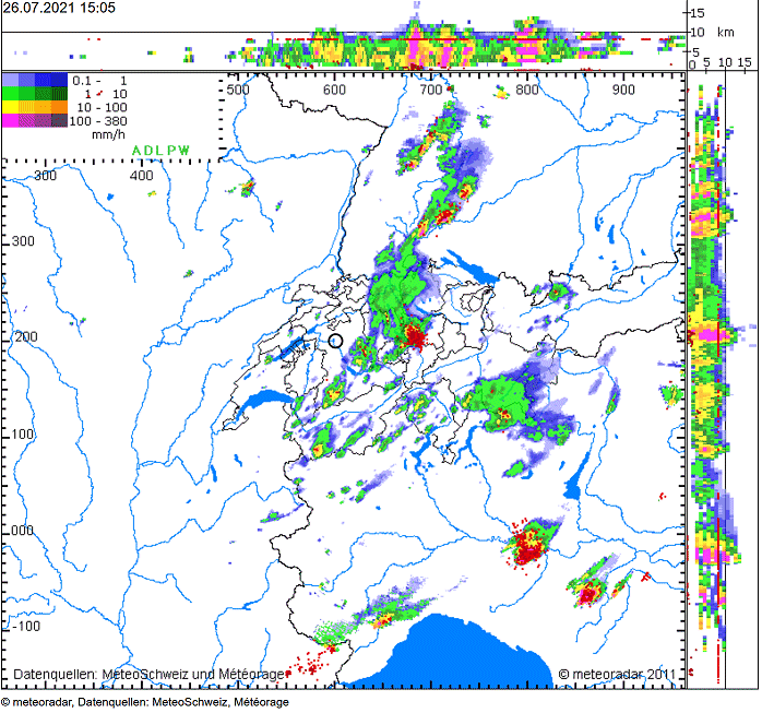
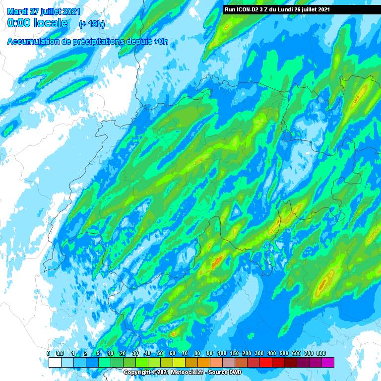
Zeitlich sehen die Modelle COSMO, AROME und ICON-D2 die grösste Entwicklung gegen 16:00. ICON-D2 rechnet am stärksten an den Voralpen, während COSMO und AROME etwas mehr im Flachland rechnen.
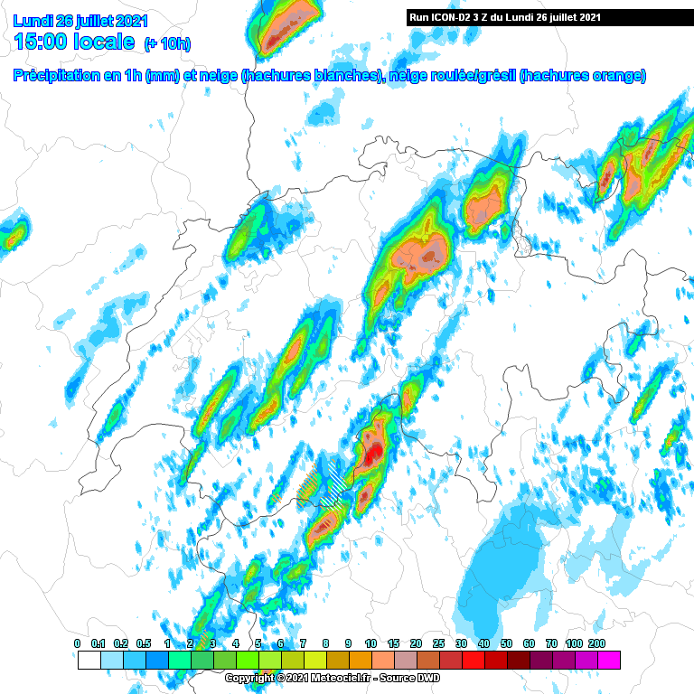
Quelle: https://www.meteociel.fr/modeles/icon-d ... =1&map=360
Niederschlagssumme dürfte erneut und an den Voralpen und im Tessin am höchsten sein.
Quelle: https://www.meteociel.fr/modeles/icon-d ... 25&map=360