Im Vergleich zum Forecast (siehe hier) zieht Estofex im definitiven Outlook die Grenzen des Level 2 insgesamt etwas grösser. Es reicht jetzt runter bis nach Nordostfrankreich und Baden-Württemberg.

Der Text die Schweiz betreffend:
A level 1 was issued for northern Spain, southern France, Switerland, Austria, northern Italy, Slowenia, northern Croatia, Hungary mainly for large hail and excessive precipitation and to a lesser extent severe wind gusts.
Quelle: estofex.orgPyrenees, southern France, Alps, northern Balkans
Mid-level ridge will cover this area and large-scale lift will be weak. However, rich low-level moisture is present that is overlapping with steep lapse rates especially in the western portions, but diurnal heating is also expected to cause instability in the east. CAPE will range around 1500 J/kg in the afternoon. Initiation is forecast over the mountains in the noon and afternoon. Pulse storms and multicells are forecast to produce large hail and excessive precipitation. Local severe wind gusts are not ruled out. Later in the day, clusters of storms may also spread into the lowlands, capable of producing large hail and severe wind gusts and also excessive precipitation. Storm activity will be rather isolated and widespread severe weather is not forecast.
Mal schauen, ob wir heute Abend von der Dynamik des Kurzwellentroges "profitieren" können. Sicher ist, dass es ab dem frühen Nachmittag bevorzugt über dem Relief (v.a. Jura) einzelne heftige Entwicklungen (Hagelgewitter mit Sturzflutgefahr) geben wird und im Laufe des Nachmittags/Abends aufgrund der Labilitätszunahme, der Annäherung des Trogs, der Zunahme der Scherung und nicht zuletzt angestossen von Outflow-boundaries auch einzelne (starke) Gewitter im Flachland zu erwarten sind.
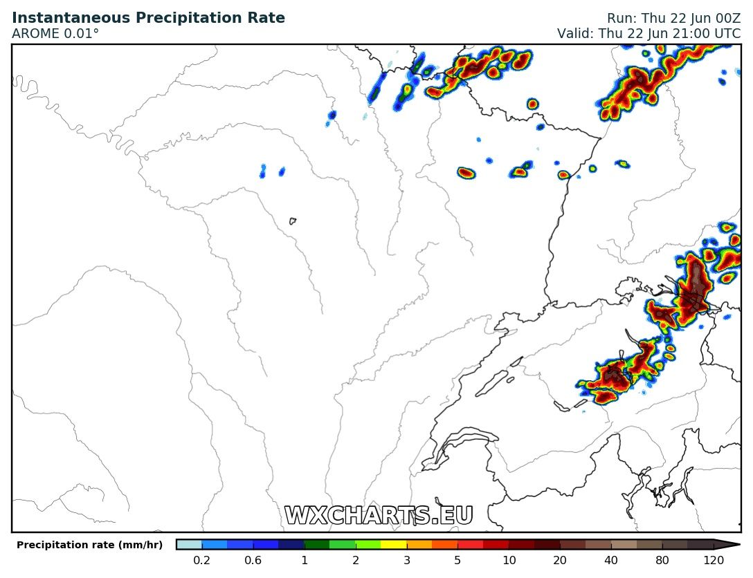
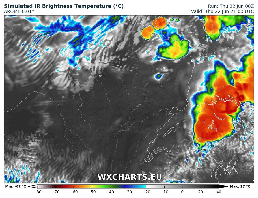
Das Arome Modell will es am späteren Abend wieder in der Nord- und Ostschweiz krachen lassen.


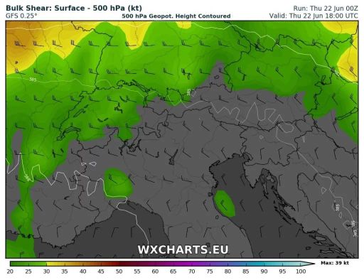
Schöne simulierte Scherung am Abend:
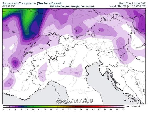
Und entsprechend gibt der Supercell Composite Parameter an:
Gruss Chris