hallo zusammen
Tatsache ist, dass wir ein persistentes Kältereservoir
über dem östlichen Nordamerika haben,
das in Richtung Atlantik drängt
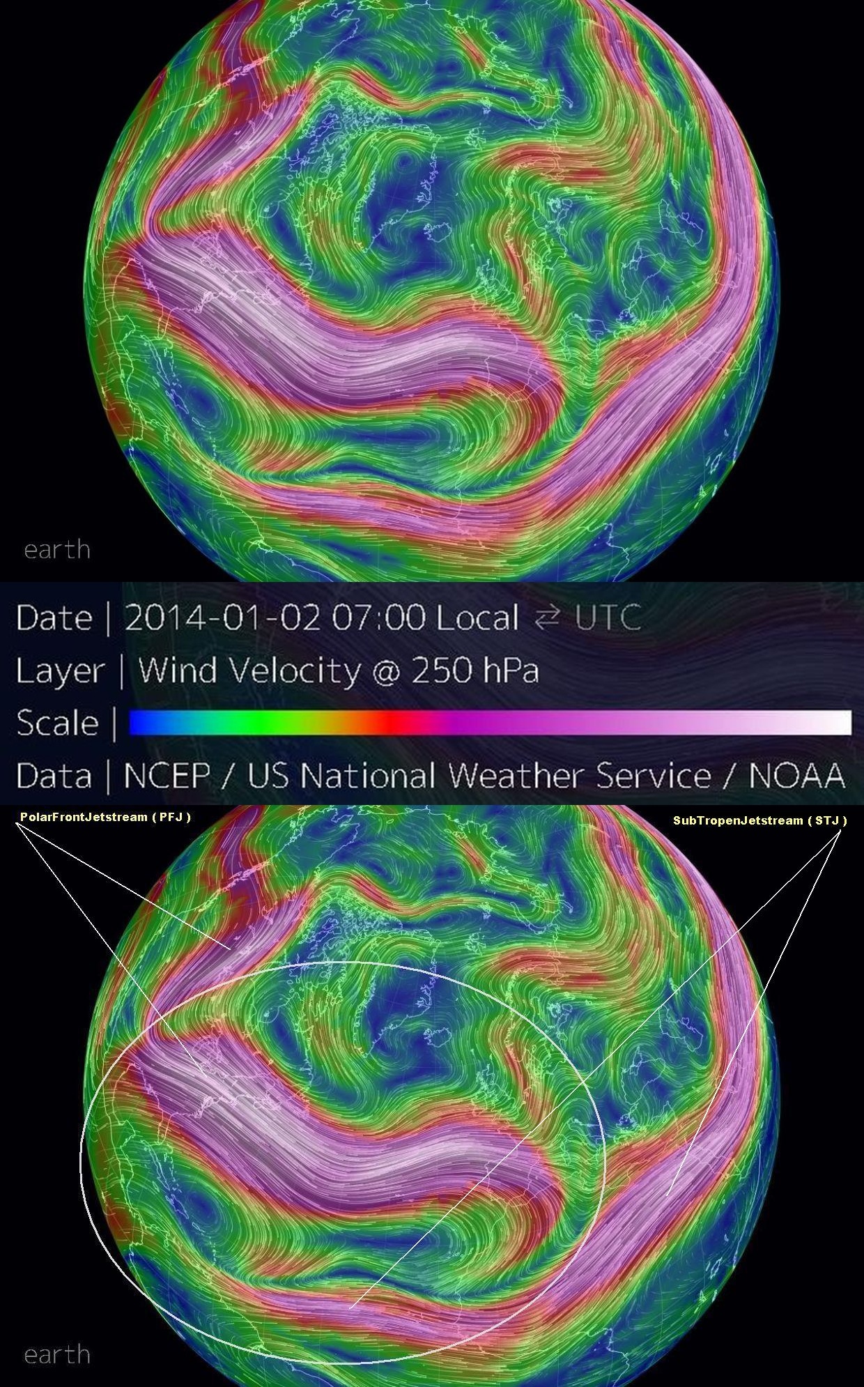
nicht nur das ... auch die windstroemung ( jet stream ) ist sehr stark
als jet stream sind die PolarFrontJetstream ( PFJ ) gemeint
seit mehreren tagen ( wochen ) haben wir diesen starken Strahlstrom
kommrnd aus NE usa richtung N atlantik ( UK )
auf der global wind map gut erkennbar
http://earth.nullschool.net
250 mb => 10500 m => wind speed 250 km/h ( weisse farbe )

zitat von estofex ( aktueller update )
across western europe a new intensification
of the northern atlantic cyclonic activity
is increasingly affecting the flow
===
ein artikel vom washington post
arctic warming
jet stream coupling may mean another winter
of extreme storms and cold air outbreaks for
eastern U.S.
variability in the occurrence and specific configuration
of a given
-NAO ( within a season )
and how these factors govern
the specifics of
nor’easter development
are not predictable beyond a week or so
i am referring here to details pertaining to the frequency
amplitude timing location and regional persistence
of major circulation features associated
with a
–NAO
the latter include mid to high latitude
blocking patterns
which frequently are the dominant influence
on the evolution and track of
potential mid atlantic coastal storms
(
more generally the same is true in regard
to potentially significant winter storms affecting europe )
atmospheric dynamics (
thermal wind ) require that winds
adjust when such temperature changes occur moreso where
the horizontal temperature gradient is largest
readily apparent is the polar jet shift southwards
( bottom right panel ) along with appearance
of a pronounced mid to high latitudinal
belt of weakened westerly winds extending through
most of the troposphere from south central canada
through northern europe and siberia
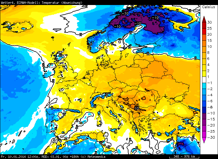
the geographic variability is illustrated by charts
of the low level ( 850 mb => ~5000 ft => ~1500 m ) temperature ( below top )
and 250 mb ( ~30000 ft => ~10500 m ) zonal wind anomalies ( below bottom )
the altitude proximate to the core of the polar jet
quelle:
http://www.washingtonpost.com/blogs/cap ... outbreaks/
===
edit
in den usa geht die post ab
polar vortex to unleash historic cold across plains ( midwest )
http://theweathercentre.blogspot.ch/201 ... -cold.html