der heutigen Nacht auf Morgen 08./09.08.2014 mit Hilfe von Estofex und Schichtleiter VBZ des DWD eröffnet *faulbin*
Freitag ... hält sich in mittleren und höheren Troposphärenschichten noch der
antizyklonale Einfluss, da der Rücken(500hPa) zunächst kurzzeitig regeneriert
wird. In der zweiten Tageshälfte schwenkt dann ein markanter Trog nach
Westeuropa heran, an dessen Ostflanke ein erster Randtrog über Westfrankreich
nordostwärts läuft und deutschland kaum berührt. Gleichzeitig erfährt ein an der
Frontalzone über Westfrankreich nordostwärts wanderndes Randtief in
trogvorderseitig günstiger Lage eine weitere Intensivierung und erreicht am
späten Abend etwa die ostenglische Küste. An dessen Ostflanke setzt in unteren
Schichten der Transport Warmluft subtropischen Ursprungs nach Deutschland ein.
Die bodennahe Strömung dreht auf Süd bis Südost zurück.
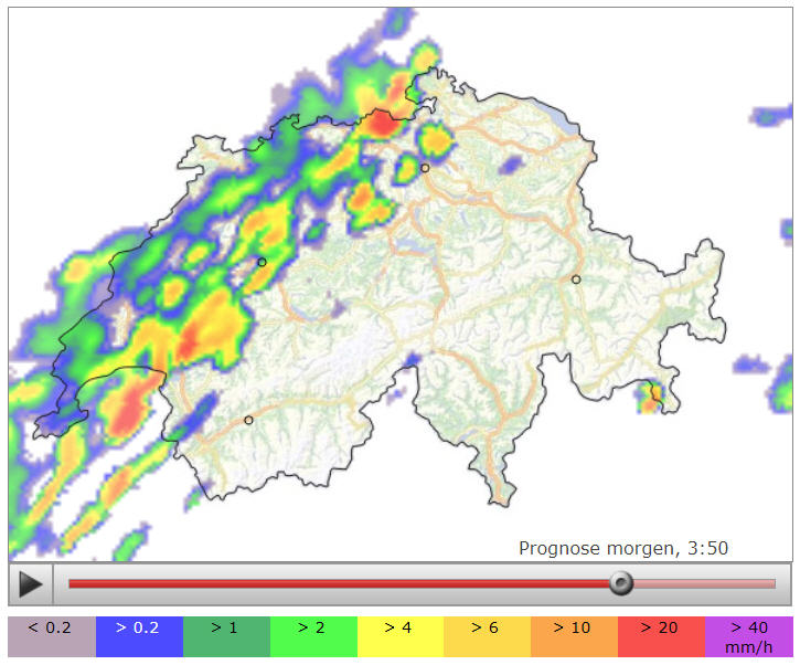
Zum Abend gelangt dann wieder labiler geschichtete Luft vor allem in den
Südwesten und Westen und die alpennahen Bereiche. CAPE erreicht Werte bis 750
J/kg, der Gehalt an niederschlagbarem Wasser steigt auf 30 bis 35 mm - erste
Gewitter sind dann dort am Abend und in der Nacht zum Samstag zu erwarten. In
der zunächst eher glatten, indifferenten südwestlichen Höhenströmung sind aber
größere organisierte Strukturen zunächst einmal fraglich.
Die Höchsttemperaturen erreichen am Freitag hochsommerliche Werte von 25 bis
fast 30°C.
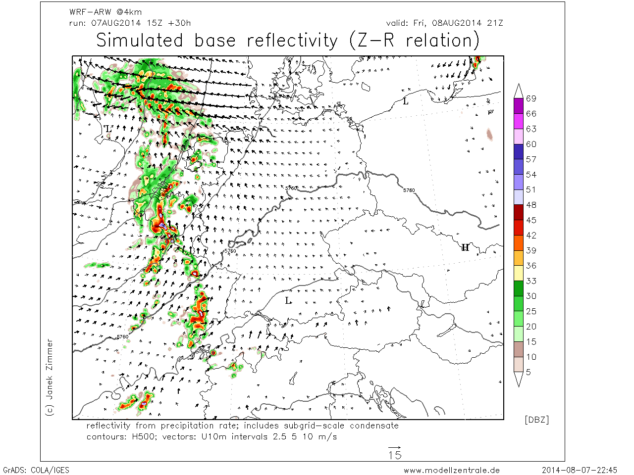
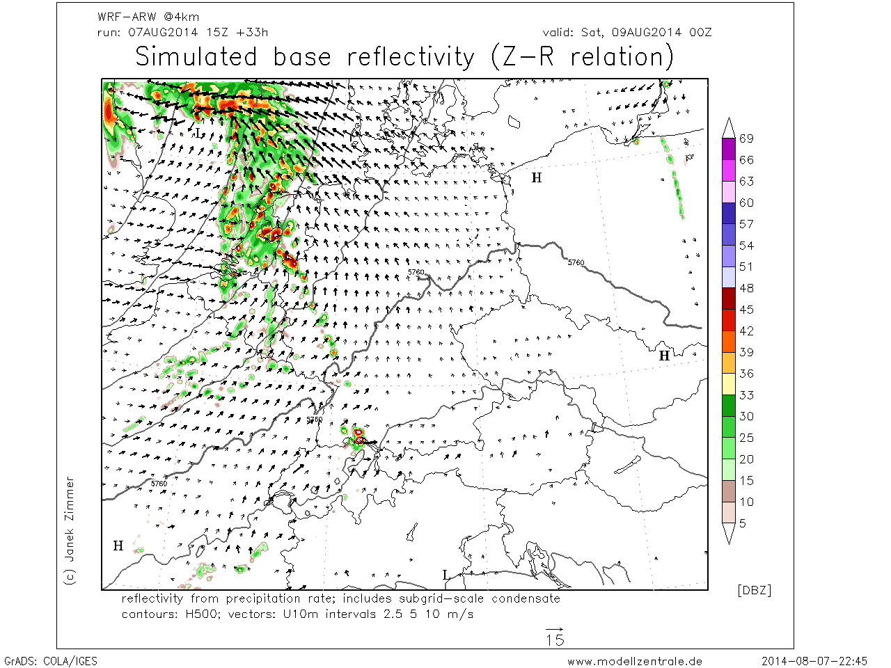
Erst im Laufe der Nacht zu Samstag scheint dann mit Annäherung eines markanten
Kurzwellentroges dynamische Hebung auf den Westen und Südwesten überzugreifen,
die Kaltfront des Tiefs vor der ostenglischen Küste erreicht vermutlich schon
den äußeren Westen und Nordwesten. Präfrontale Schauer und Gewitter greifen
dabei über den Rhein ostwärts aus. Aufgrund der vor allem niedertroposphärisch
zunehmenden Scherung sind auch organisiertere Strukturen hoch reichender
Konvektion vorstellbar.
Hierzulande scheint tagsüber ein recht massiver Deckel vorhanden zu sein, der nur mit updrafts aus der Orographie geknackt wird, bzw.Storm Forecast
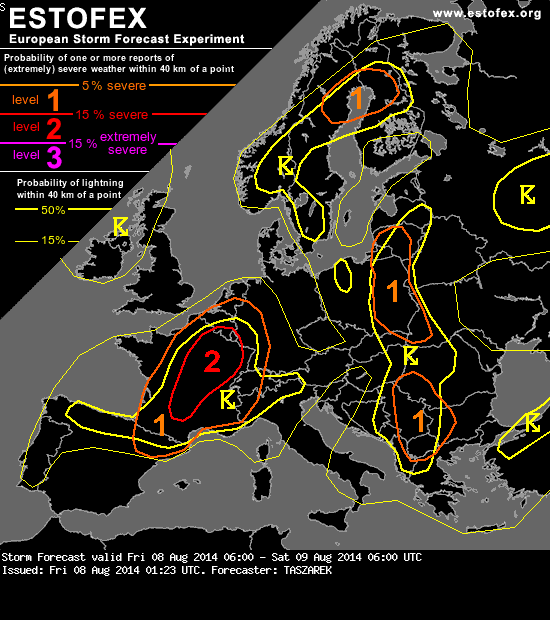
Valid: Fri 08 Aug 2014 06:00 to Sat 09 Aug 2014 06:00 UTC
Issued: Fri 08 Aug 2014 01:23
Forecaster: TASZAREK
A level 2 was issued for France and parts of Benelux mainly for tornadoes, large hail severe wind gusts and excessive precipitation
A level 1 was issued for central and S France, NE Spain, Switzerland and parts of Italy mainly for large hail
...France, Benelux, parts of Germany, parts of Switzerland and Italy...
Rich boundary-layer moisture overlapping with steep vertical lapse rates in central and southern France will result in CAPE exceeding 2000 J/kg and reaching up to 3500 J/kg locally. In the axis of low pressure bay in strong horizontal pressure gradient extending from UK to France, wave on the top of this feature will create good conditions for severe weather phenomena. Although 0-6km shear is expected to be moderate (mainly 15 m/s with 20m/s locally), 0-1km and 0-3km shear due to mid and low tropospheric jet streak seems to be significant. The first one together with low cloud base and moderate instability will point out risk for tornadic supercells. The limiting factor may be associated with the vertical directional wind shear which seems to be not significant (SRH ~ 100m2/s2 mainly with SW flow). Even though, the overlap of LLS amounting 12m/s with mid and low level jet streak and CAPE over 1500 J/kg cannot rule out isolated significant tornado event in central and NE France. Second main threat related to strong 0-3km shear (>15 m/s) overlapping with moderate and high instability may result in quasi-linear convective system moving over central and NE France in NE direction. Sideward and forward storm building may organize convection into bow echo feature and generate severe wind gusts. Embedded and isolated supercells will be also capable of producing large hail and excessive precipitation. The highest risk for flash flood phenomena is located in central, N France and Benelux due to PW values exceeding 40mm. The highest threat for severe weather is expected to start from 15Z when convection will be likely to organize in central and SW part of France and will remain up to 00Z when the system will move in NE direction up to Benelux. Convection forcing sources are predicted from low-level convergence zones over France, potential vorticity advection and cold frontal boundary moving easterly through France and Benelux, and may provide convection up to late night hours.
mit large scale lift und/oder frz. outflow boundaries im Laufe der Nacht abgebaut wird - scheint was für die Blitzfotographen zu sein.
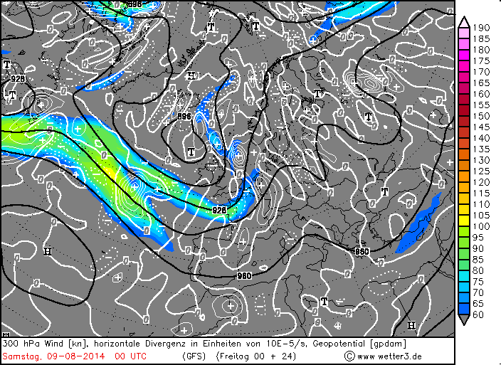
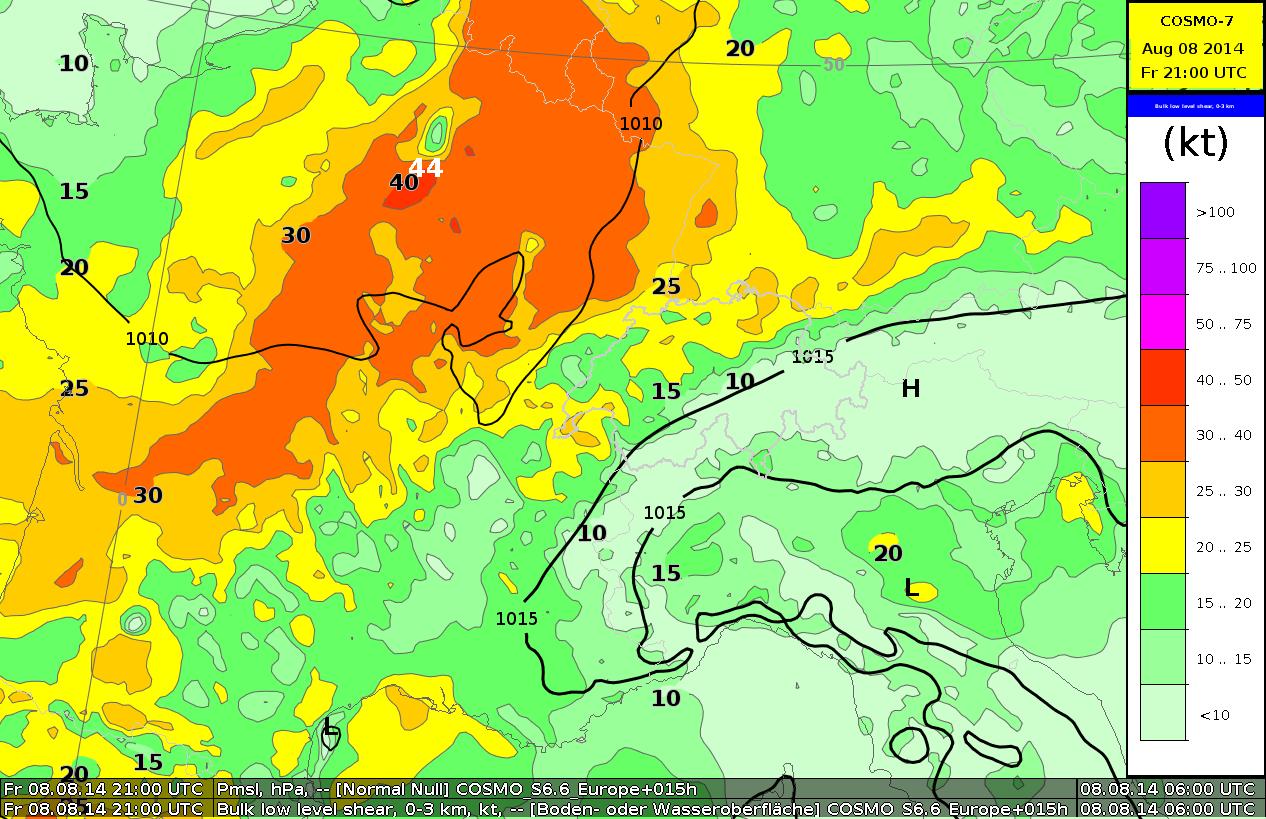
COSMO-7 bulk low level wind shear 0-3km 21 UTC:
COSMO-2 Vorhersage-TEMP für Ajoie 21 UTC:
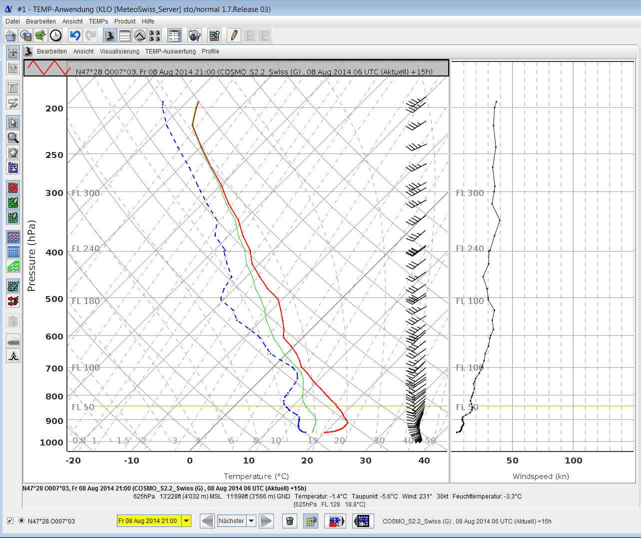
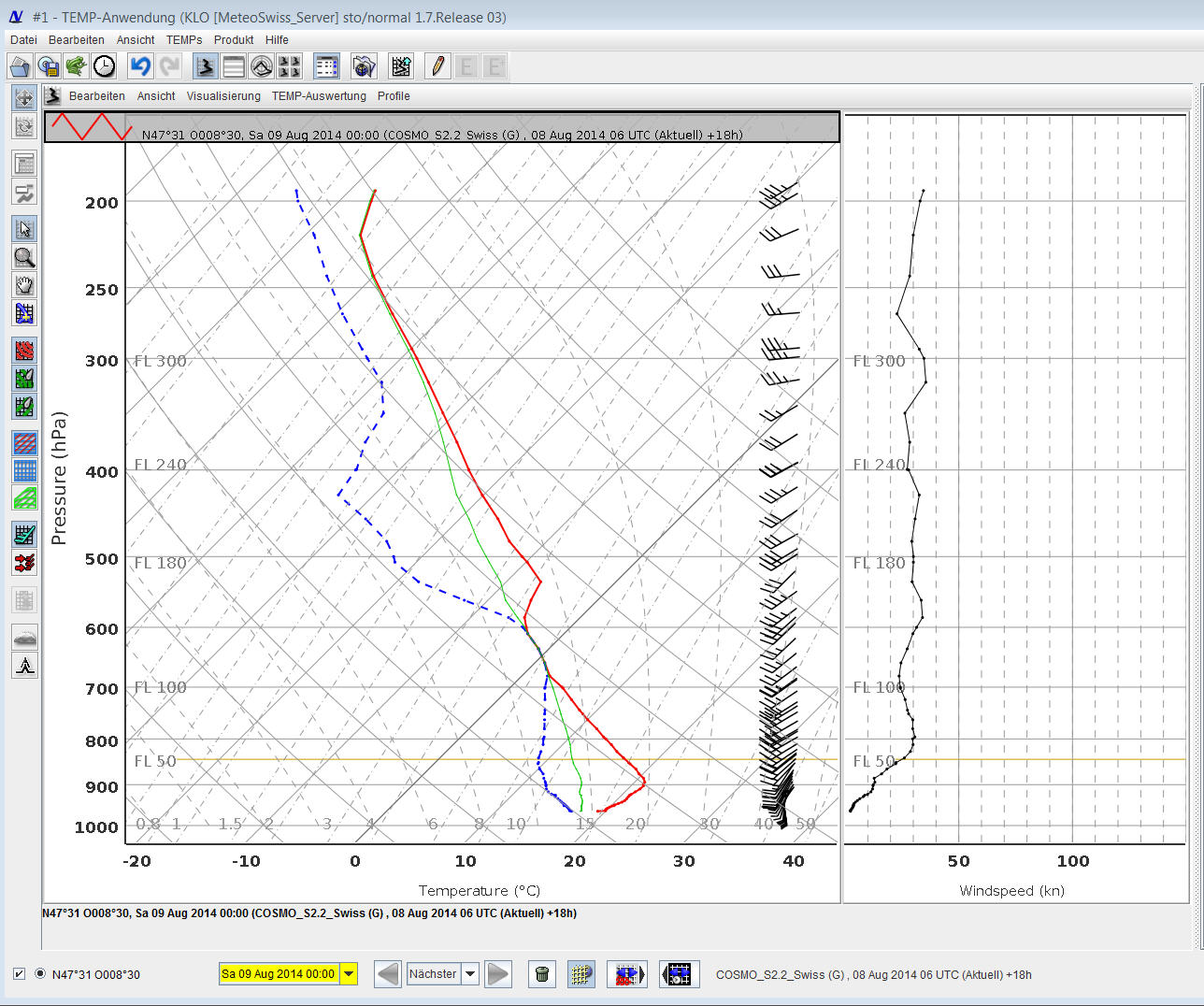
COSMO-2 Vorhersage-TEMP für Zürich-Kloten LSZH 00 UTC: