NOWCAST: Gewitter vom Sonntag 05.07.2009
Verfasst: So 5. Jul 2009, 00:49
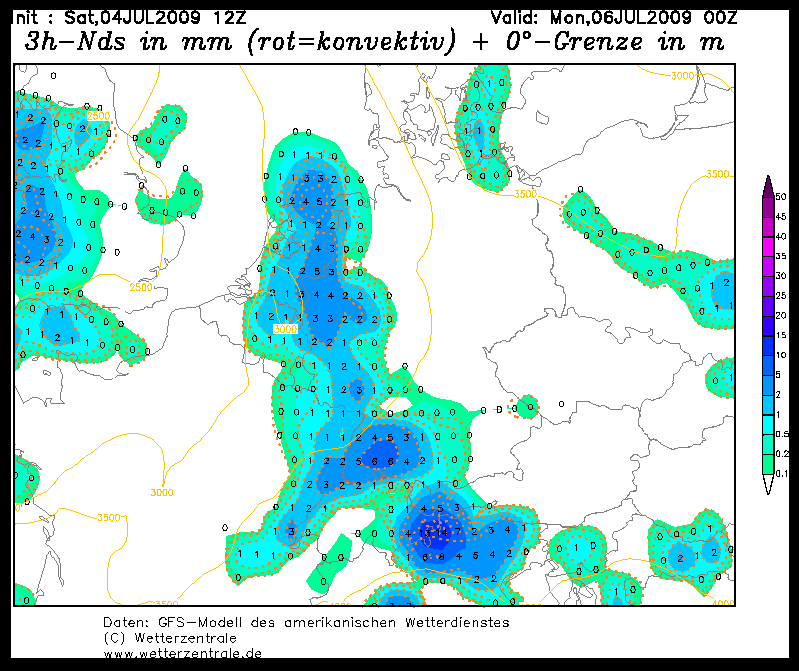
Ich starte für morgen einfach mal nen Thread. Hier der ESTOFEX Forecast

Storm Forecast
Valid: Sun 05 Jul 2009 06:00 to Mon 06 Jul 2009 06:00 UTC
Issued: Sat 04 Jul 2009 22:24
Forecaster: SCHLENCZEK
A level 1 was issued for extreme S France and NE Spain mainly for severe gusts and large hail.
A level 1 was issued for N Italy and SE Austria / N Balkans towards N Poland mainly for excessive precipitation and large hail.
A level 1 was issued for E France and S Germany mainly for excessive precipitation.
SYNOPSIS
The upper flow pattern will not change much on Sunday. An upper low west of Ireland translates eastward and its cold front, initially located from SE England via NW France towards NW Spain, will cross France and the Benelux countries on Sunday. Another frontal boundary is located from S Norway via Denmark and NE Poland towards Ukraine and western Russia, separating cool and dry air in the north from hot and moist air in the south. Except for the convection in western-central and NE Europe, thunderstorms should be diurnally driven and evolve in an environment with weak vertical shear. In the vicinity of the subtropical jet streak over the western and central Mediterranean, GFS and WRF show some instability but no precip - except for NE Spain. Again, excessive precipitation will be the main threat, especially in southern Europe.
...E France, S Germany...
In the afternoon / evening hours, thunderstorms should also develop in E France and southern Germany in an environment with some hundred J/kg MLCAPE and very weak vertical shear. Storms will likely merge into some clusters that may produce large precipitation sums which will result in local flash floods.
...E-central France, Benelux countries, W Germany...
Ahead of a frontal wave over western Europe, increasing LL moisture and some cooling at upper levels lead to about 1 kJ/kg MLCAPE in an environment with 10 - 15 m/s deep layer shear. Most of the shear is confined to the lowest 3 km and therefore multicell storms will probably organize into a line. Locally, severe gusts and large hail may occur but a threat level should not be warranted at the moment.
Quelle: http://www.estofex.org