Guten Morgen Zusammen
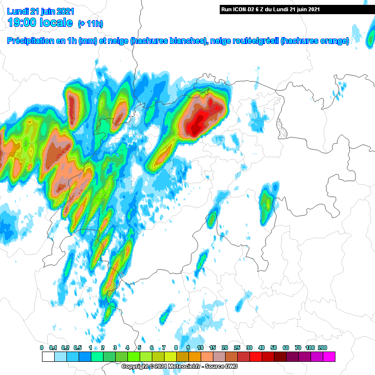
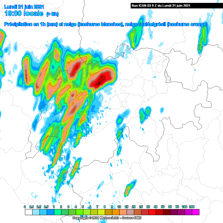
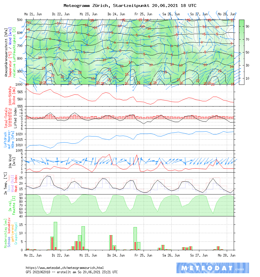
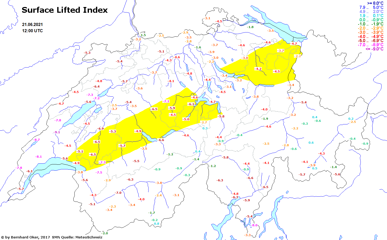
Potential ist heute auf jeden Fall vorhanden, auch wenn die CAPE Werte nicht mehr so hoch sind, laut GFS nicht über 1000 J/kg bei uns. Alle Modelle rechnen auf jeden Fall mit Niederschlag, Cosmo und GFS bereits im späteren Nachmittag, AROME und ICON-D2 eher am Abend.
Estofex hat für die ganze Schweiz einen Level 2:

...France, Switzerland, S Germany, N Austria...
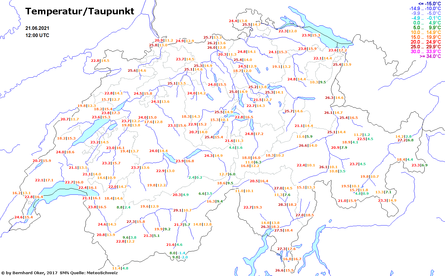
Models indicate quite humid profiles with weakly capped MLCAPE mostly in the 800-1500 J/kg range, overlapped by 15-20 m/s 0-6 km shear. Cloud base heights should be mostly in the 1000-1500m range. In lack of clear frontal/through forcing, storms form as isolated and clustered multi- and supercells, with large hail and severe wind gusts as the main threat. The hodographs lack the curvature and low-level shear required for tornadoes. During the evening an MCS may form, as seems indicated by several models, traversing S Germany into Czechia.
Quelle: estofex.org
Gruss
Vortex