Seite 7 von 12
Sturmpotenzial Do/Fr 01./02.03.2007
Verfasst: Mi 28. Feb 2007, 21:37
von Stefan (Rothenburg)
Hallo zäme
Nur mitlesen ist auf die Dauer keine Lösung... habe mich daher auch mal aktiv eingeklinkt,
auch wenn ich (noch) kein "Wetterwissenschaftler" bin.
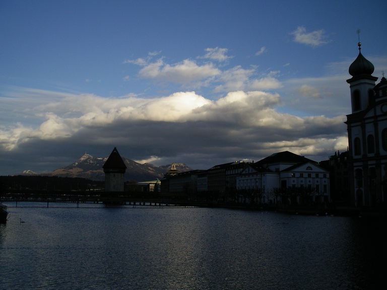
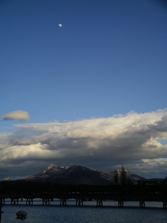
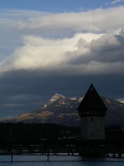
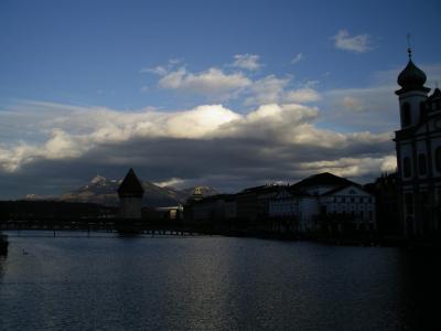
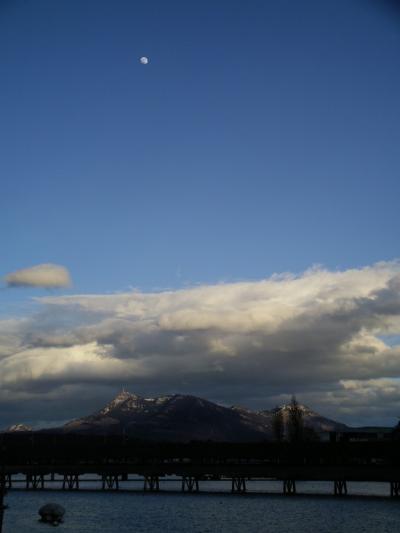
Heute Nachmittag in Luzern heisse, rasch wechselnde Wetterstimmungen. Mal Starkregen für ein
paar Minuten, dann wieder Aufhellungen bei sehr milden Temperaturen. Die Wolken jagten
von Pilatus zur Rigi, als sei ein Zeitraffer aktiviert.
Mit vielen Grüssen
Stefan
Sturmpotenzial Do/Fr 01./02.03.2007
Verfasst: Mi 28. Feb 2007, 22:45
von Badnerland
Sali,
Estofex mit Level1:
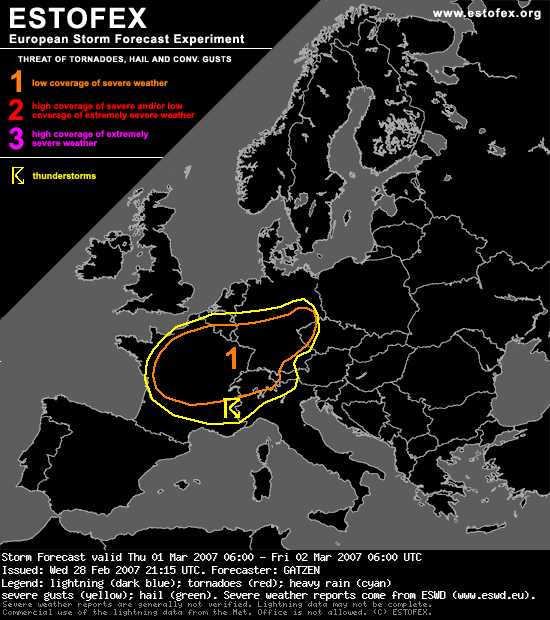
"DISCUSSION
Northern France, Belgium, central Germany
Latest models show a relatively strong upper jet streak that spreads eastward over northern France, reaching southern Germany during the period. At lower levels, associated frontal wave propagates eastward over Germany and Poland during the day. Very moist maritime air mass originating from central Atlantic will spread especially into northern France and south-western Germany in the warm sector. Models suggest dewpoints of 7 to 10°C south of the cold front. Aloft, mid-level height falls is expected in the range of the propagating trough. Current thinking is that weak instability will form in the warm sector air mass, but uncertainty is quite large at this time. Limiting factor may be relatively cold boundary-layer air mass, but latest obsevations indicate dewpoints of 6 to 10°C over northern France at 20Z. Given strong low-level forcing along the cold front, a narrow band of convection may develop in the early morning hours from northern France to southern Belgium that will rapidely propagate eastward into eastern central Germany until noon. Given very strong low-level jet in the range of the cold front, reaching more than 30 m/s at the 850 hPa level, strong low-level wind shear in the warm sector of more than 15 m/s as well as favorable veering with more than 300 J/kg 0-1 km SRH is expected, and small bowing lines as well as small mesocyclones are forecast. Severe wind gusts are anticipated the most significant severe threat, but tornadoes are also not ruled out, depending on the amount of low-level buoyancy. Convection will reach western Poland during the day, where decreasing low-level buoyancy and CAPE will likely cause weakening storms.
Central France, Switzerland
Another frontal wave/upper vort-max is expected to travel eastward in the wake of the mentioned system. While associated warm-sector air mass is quite similar to the first frontal wave, low-level forcing/convergence is expected to be weaker in the wake of the first system. However, given fast moving cold front, at least some convection is expected to develop, and a band of stratiform rain with embedded thunderstorms is not ruled out. Given strong low-level wind shear as well as favorable veering comparable to the first frontal wave, severe wind gusts and tornadoes may form during the afternoon/evening hours along the front that will rapidely move eastward into western Alps. Intense precipitation will pose another threat especially over western Alpine region during the evening and night hours."
Quelle:
http://www.estofex.org
Sturmpotenzial Do/Fr 01./02.03.2007
Verfasst: Mi 28. Feb 2007, 23:09
von Kurt
Hallo zäme
Estofex auf deutsch
www.wetteran.de/estofex_de/index.html
---
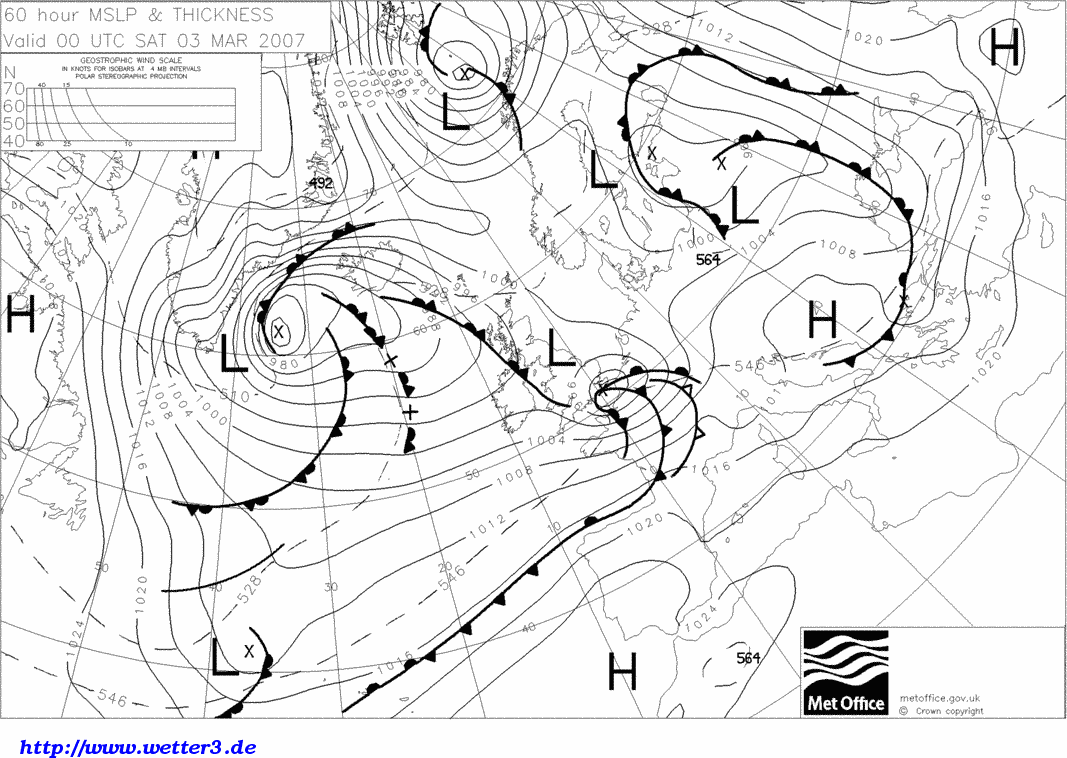
In der Nacht auf Samstag erneut Sturmgefahr ?
Nach UKMO zieht ein weiteres Randtief südlich von England Richtung Norddeutschland
und verursacht westlich und südlich davon ein starkes Windfeld
Gruess, Kurt
Sturmpotenzial Do/Fr 01./02.03.2007
Verfasst: Mi 28. Feb 2007, 23:31
von Kurt
GFS 18z zieht mit UKMO (Tief am Samstag deutlich stärker)
Neu : Sturmpotenzial Do/Fr/Sa 1./2./3.März 2007

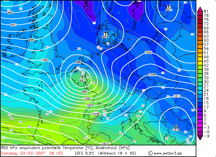
Aber zuerst kommt am Donnerstag, 1.März'07 die FREDY Welle
Gruess, Kurt
Sturmpotenzial Do/Fr/Sa 01./02./03.03.2007
Verfasst: Mi 28. Feb 2007, 23:50
von Gino
Original von Kurt
GFS 18z zieht mit UKMO (Tief am Samstag deutlich stärker)
Neu : Sturmpotenzial Do/Fr/Sa 1./2./3.März 2007
Aber zuerst kommt am Donnerstag, 1.März'07 die FREDY Welle
Gruess, Kurt
=
... und hier ist die Fredy Welle.

Sturmpotenzial Do/Fr/Sa 01./02./03.03.2007
Verfasst: Do 1. Mär 2007, 00:10
von Longhair
Original von Kurt
Hallo zäme
Estofex auf deutsch
www.wetteran.de/estofex_de/index.html
---
In der Nacht auf Samstag erneut Sturmgefahr ?
Nach UKMO zieht ein weiteres Randtief südlich von England Richtung Norddeutschland
und verursacht westlich und südlich davon ein starkes Windfeld
Gruess, Kurt
Nana, ziemlicher Giftzwerg, den sie hier gerechnet haben! :O
Sturmpotenzial Do/Fr/Sa 01./02./03.03.2007
Verfasst: Do 1. Mär 2007, 06:01
von Alfred
Auch GSF rechnet Freitag auf Samstag weiter mit recht stürmisch!
Alfred
[hr]
Sturmpotenzial Do/Fr/Sa 01./02./03.03.2007
Verfasst: Do 1. Mär 2007, 07:19
von Gino
Original von Markus Pfister
@Tinu: Damals gab es Modelle, die praktisch kein Randtief drin hatten.
Das sieht ja mager aus (aus welchen Gründen auch immer):
http://www.sturmforum.ch/forum_uploads/ ... 120225.GIF
Aha, Bolam hat etwas drin *gähn*:
http://www.sturmforum.ch/forum_uploads/ ... 120537.gif
Oha, so sah dann das Bolam 24 Stunden später für den gleichen Termin aus:
http://www.sturmforum.ch/forum_uploads/ ... 120456.gif
Es geht mir hier NICHT darum, jetzt auf Panik zu machen, weil die grossen
Zutaten, wie Mat schrieb, weniger ausgeprägt sind, aber wir haben endlich
mal die Gelegenheit, die Unberechenbarkeit eines auch nur annähernd ähnlichen
Musters (ein Randtief, zwei Randtiefs, eine Welle, zwei Wellen???) zu verfolgen.
Das finde ich spannend.
Gruss
Markus
=
Und was sind diese Bodenwetterkarten? ---> Butter?.
Aus meinem Archiv ...
Bilder und Bodenwetterkarten ...
http://www.shv-fsvl.ch/d/wetter/archiv/1001.htm
http://de.search.yahoo.com/search/image ... ief+lothar
http://www.arth-online.ch/termine/ite/310/index2.html
Sturmpotenzial Do/Fr/Sa 01./02./03.03.2007
Verfasst: Do 1. Mär 2007, 08:19
von Michael (Gossau ZH)
meteoschweiz hat nun für teile der schweiz auf gefahrenstufe orange erhöht.
meteonews hat für teile der schweiz auf gefahrenstufe rot erhöht.
bei beiden ist dies jeweils die zweithöchste warnstufe.
Sturmpotenzial Do/Fr/Sa 01./02./03.03.2007
Verfasst: Do 1. Mär 2007, 08:32
von Gino