Seite 4 von 5
Re: Wetterextreme Südhemisphäre Sommer 2010/2011
Verfasst: Mi 2. Feb 2011, 10:14
von HB-EDY
hier noch ein "live-ticker" aus Australien...
http://www.news.com.au/breaking-news/fl ... 5998711771
salve
Edy
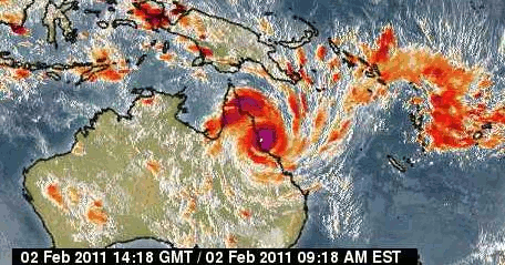
Zyklon Yasi Australien
Verfasst: Mi 2. Feb 2011, 11:39
von Urbi
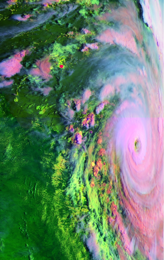
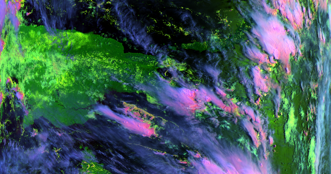
Metop2
01-02-2011
23:55 und 23:58 utc zusammengefügt
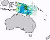
_______________________________________
news.com.au
Aktuelle Karten
http://www.bom.gov.au/products/IDQ65002.shtml
Gruss
Urbi
Re: Wetterextreme Südhemisphäre Sommer 2010/2011
Verfasst: Mi 2. Feb 2011, 12:41
von Kaiko (Döttingen)


10.16pm There's been record wave height -
6.6m - this afternoon off Townsville. "This is the highest that has ever been recorded since measurements began in 1975," Premier Anna Bligh said. Similarly in Cardwell we are planing for a storm surge of over
7m over the high tide mark, Lucinda Beach 4m and at Cairns 2.6m.''
2.10am Townsville authorities say there is no way of knowing how many homes will be inundated as a result of an expected record storm surge as cyclone Yasi belts the north Queensland coast. A wave height of
9.5 metres had been recorded at the city,
almost 3 metres above the expected level, but authorities will not be able to determine the effects of the storm surge until after the cyclone has passed
http://www.news.com.au/breaking-news/fl ... 5998711771
Re: Wetterextreme Südhemisphäre Sommer 2010/2011
Verfasst: Mi 2. Feb 2011, 13:00
von Bernhard Oker
Chaser Livestream:
http://www.ustream.tv/channel/test222223435432e
Livestream Townsville:
http://www.ustream.tv/channel/caillins13
Update 14:20: Beide Channel jetzt leider Offline.
Gruss
Bernhard
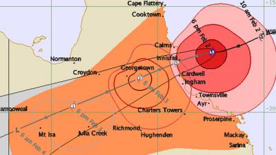
Re: Wetterextreme Südhemisphäre Sommer 2010/2011
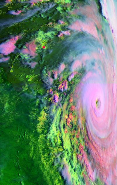
Verfasst: Mi 2. Feb 2011, 13:30
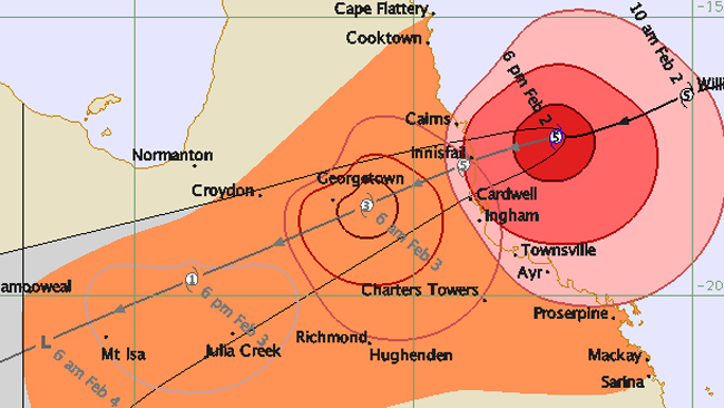
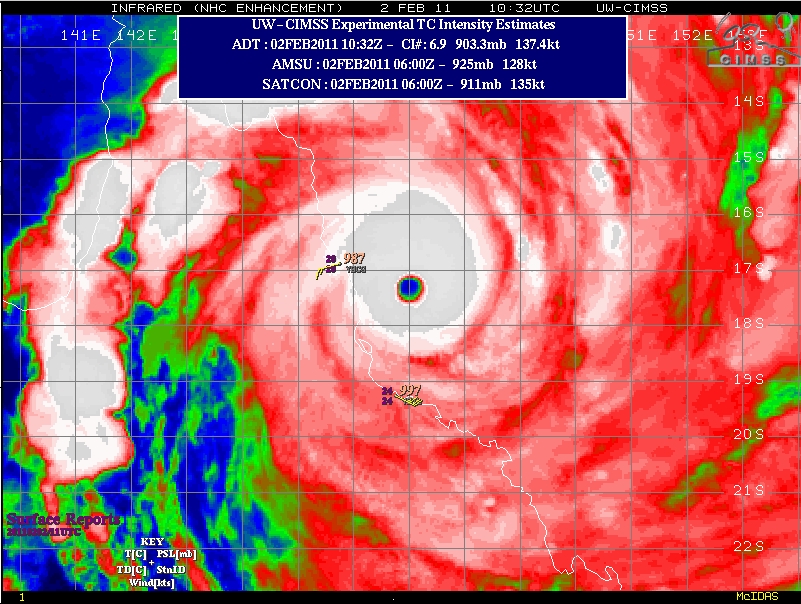
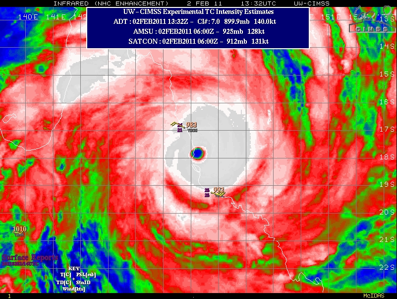
von Alfred
Sali
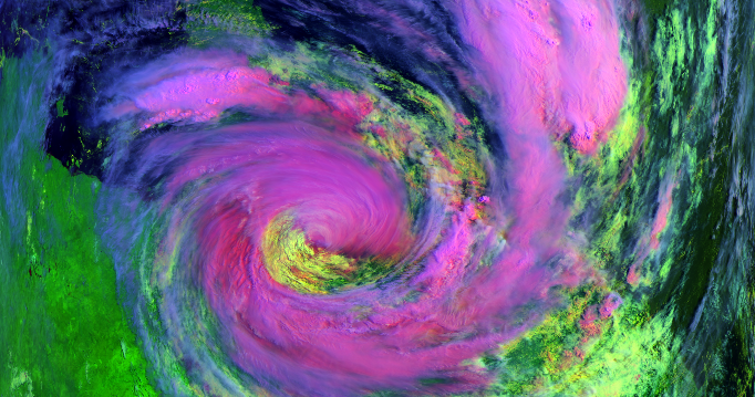
IR-Bild 10:32 UTC; Gelbe Linie Init 31.Jan. 12Z; Landfall 02. Jan. 16 UTC;
Pink Init 01. Jan. 12Z; Landfall 02. Jan. 13 UTC.
Voraussichtlicher Landgang bei Innisfall bis Towsville = 192 Kilometer.
Gruss, Alfred
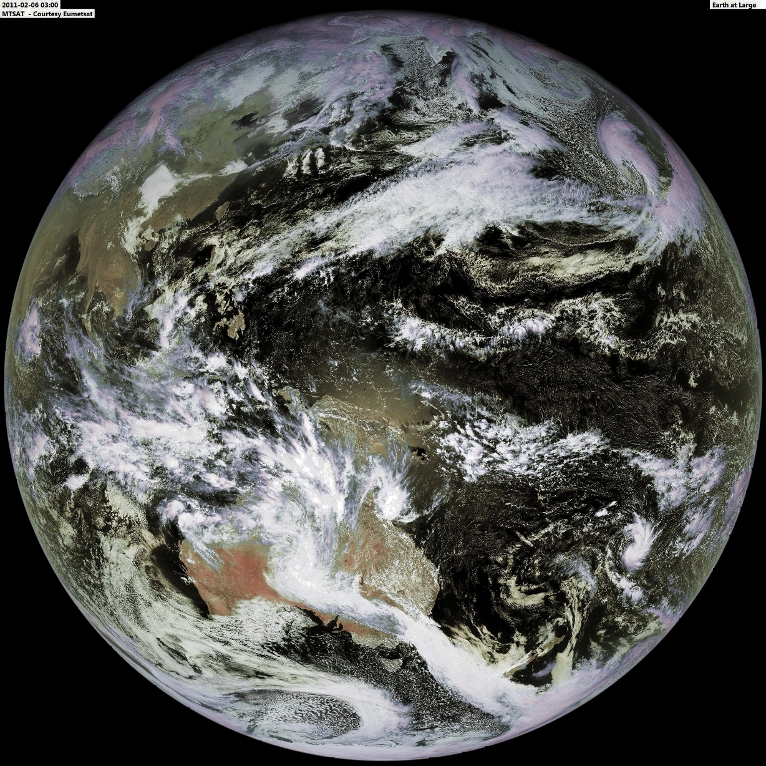
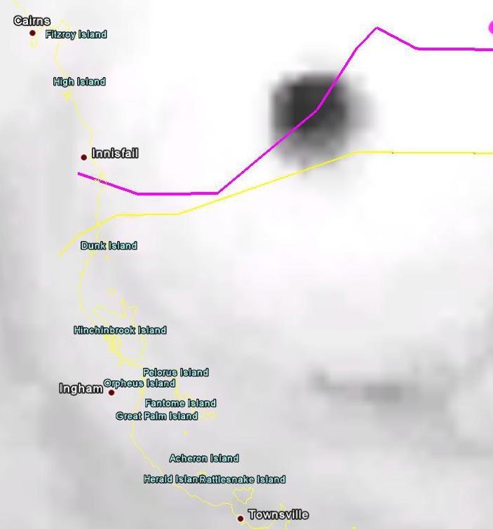
Zyklon Yasi Australien 02 02 2011
Verfasst: Mi 2. Feb 2011, 19:55
von Urbi
_____________________________________________
02 02 23:40 utc
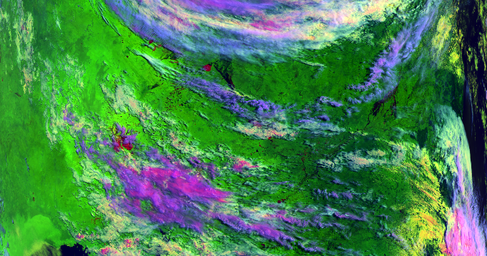
06 02 03:00utc
Urbi
Re: Wetterextreme Südhemisphäre Sommer 2010/2011
Verfasst: Do 3. Feb 2011, 15:03
von nordspot
Hi@ all
Der Sturm schwächt sich zusehends ab, hat jedoch immensen Schaden hinterlassen
http://www.news.com.au/pictures/gallery ... 511?page=1
@ Urbi: merci f. die Zusammenstellung der Bilder

Gruß
Ralph
Re: Wetterextreme Südhemisphäre Sommer 2010/2011
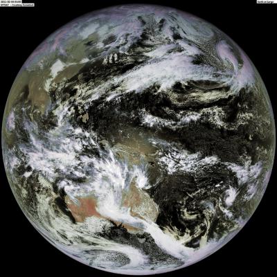
Verfasst: Sa 5. Feb 2011, 11:12
von Kaiko (Döttingen)
Re: Wetterextreme Südhemisphäre Sommer 2010/2011
Verfasst: Sa 5. Feb 2011, 16:58
von nordspot
Hi
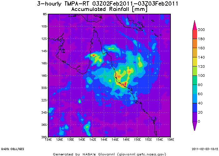
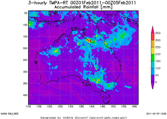
Die Überreste von Zyklon Yasi haben nun auch in Victoria verbreitet zu Unwetterartigen Gewittern geführt mit schlimmen Überschwemmungen. Es ist von CAPE Werten um 3000 und LI's von -6 die Rede

Jetzt kriegt das Ganze wieder etwas Nahrung von der feuchtwarmen Meeresluft im Süden Australiens....
http://www.bbc.co.uk/news/world-asia-pacific-12373696#
http://www.youtube.com/watch?v=JqSoMPDQ ... r_embedded
Trockene Grüße
Ralph
Re: Wetterextreme Südhemisphäre Sommer 2010/2011
Verfasst: Mo 7. Feb 2011, 14:36
von Urbi