Re: Forcasting: Gewitterlage 8. - 10. Mai 2009
Verfasst: Fr 8. Mai 2009, 06:58
Gutenmorgen zusammen
Estofex


Estofex
In Zusammenarbeit mit meteoradar
https://www.sturmforum.ch/
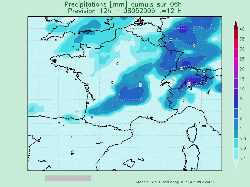
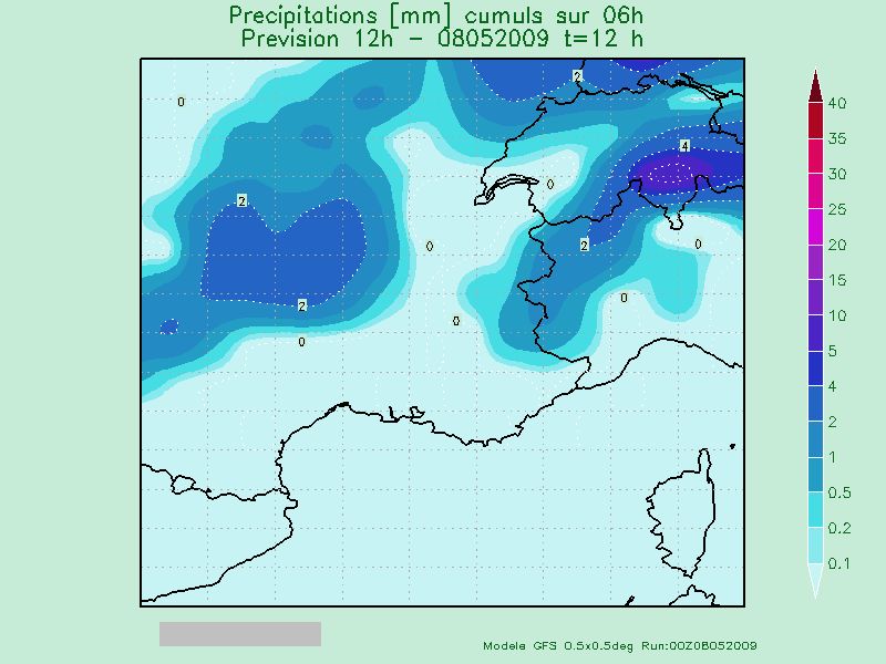
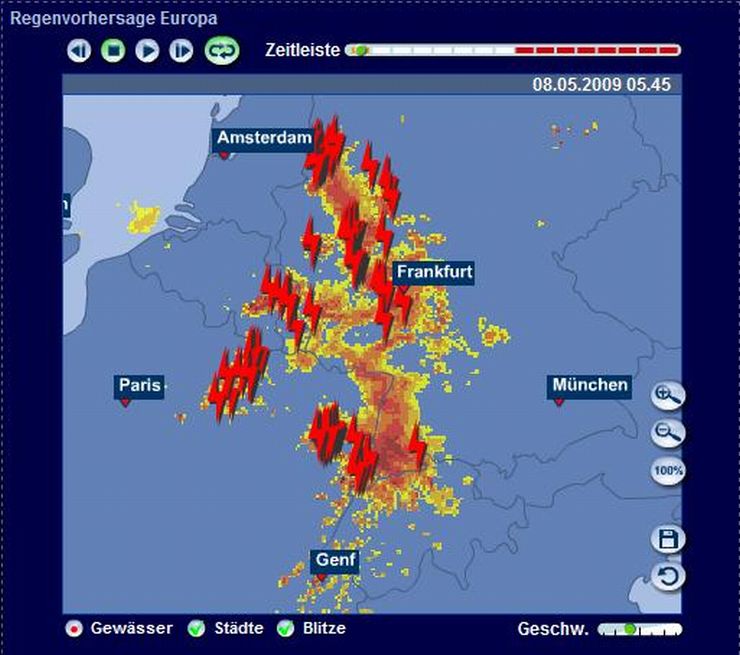
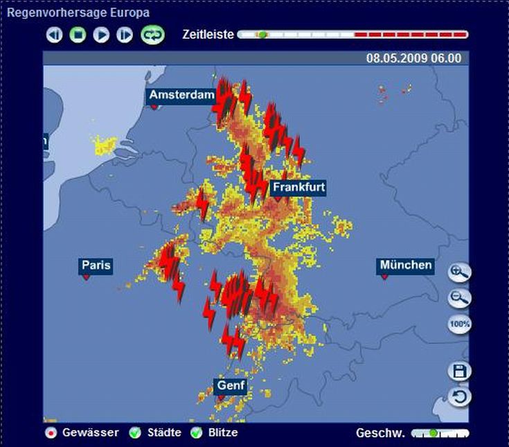
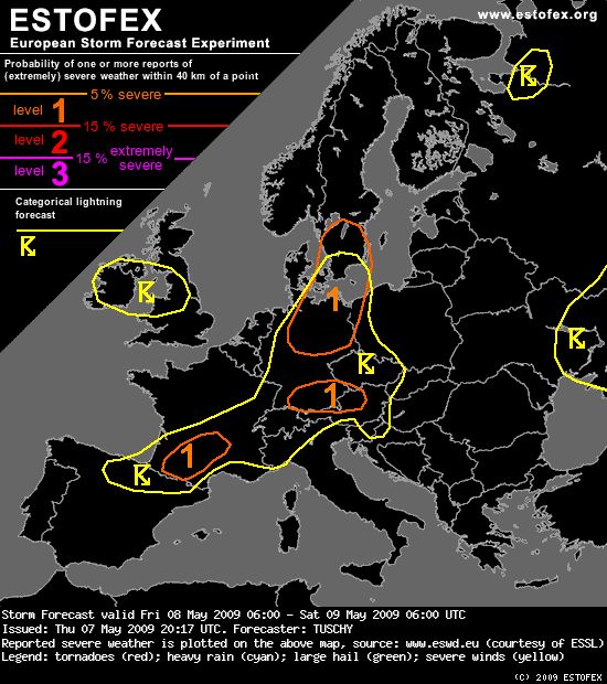
Ein spannender Wettertag!... S-France, Switzerland and parts of Austria all day long over highlighted regions in France and at the latest after 12Z-15Z over the rest of the area ...
Despite the exaggeration of GFS regarding surface dewpoints (locally more than 5°C overrated over SW-France), the boundary layer indeed yields dewpoints in the lower to mid tens. A weak Spanish plume fans out over the area, but lapse rates are not too steep, so MLCAPEs of 500-locally 1kJ/kg build along a SSW-ENE aligned convergence zone, later re-enforced by a southward sliding cold front, which also stalls out somewhere over S-France/W-Alps during the night. The airmass is weakly capped at best, so thunderstorms initiate over S-/SE-France and Switzerland all day long and also over S-Germany/most parts of the Alps during the early afternoon hours. The messy picture gets complete as initiation occurs due to ENE-ward traveling short-waves, upslope flow along the mountains and persistent convergence along the boundary over S-France.
Wind increases somewhat during the afternoon hours with DLS of 15-20m/s, so isolated large hail and strong wind gusts are likely, especially during the more discrete phase of those storms. Rapid clustering occurs and the main hazard then shifts to heavy rain with the following arguments:
i) flow at the lower levels is aligned normal to the boundary with mid-/upper winds blowing near parallel to it, so convergence along southward moving outflow boundaries favors new cell growth with some training possible
ii) ECMWF and GFS both hint on a moist atmosphere at the lowest 3km, especially over W/NW Switzerland with an increasingly deep warm cloud layer
iii)just weak to moderate shear occurs, which keeps entrainment effects low
A few spots just west of Switzerland and also along the W-Alps could indeed see rain amounts, which match our criterion, but this depends mostly on the location of those convective clusters, so we did not issue a level-1 for that hazard. The level-1 over S-Germany/NW-Austria and the other one over SW-France imply mainly large hail/isolated severe wind gusts. Especially over SW-France, thunderstorm coverage might be more sporadic, but more isolated nature should bring hail chances up. Thunderstorms diminish after sunset as CAPE vanishes.