Seite 4 von 4
Supertaifun CHABA, Kat. 5 Wirbelsturm!
Verfasst: Mo 30. Aug 2004, 22:22
von Gino
...im Atlantic scheint was los zu sein...nach Gaston kommt jetzt Hermine...und in Afrika(Atlantic)
siehe selber auf der Mappe->Link...formiert sich einen neuen Cyclone...(Cyclone Formation)
http://www.sturmforum.ch/forum_uploads/ ... 222259.jpg
Gino
Supertaifun CHABA, Kat. 5 Wirbelsturm!
Verfasst: Di 31. Aug 2004, 04:47
von Andreas (Zürich)
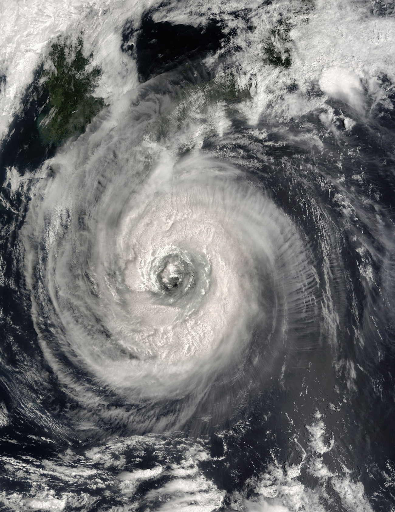
NASA’s Terra satellite captured this true-color image of Typhoon Chaba on August 29, 2004, at 1:45 UTC. At the time Chaba was located approximately 537 km (334 miles) south-southeast of Sasebo, Japan, and was moving towards the west-northwest at 15 km/hr (9 mph). Maximum sustained winds were near 194 km/hr (121 mph) with higher gusts to 241 km/hr (150 mph). Chaba means ‘hibiscus’ in Thai, and the storm does have an awesome beauty as it swirls in the Pacific south of Japan.
- Editiert von Andreas (Zürich) am 31.08.2004, 04:55 -
Supertaifun CHABA, Kat. 5 Wirbelsturm!
Verfasst: Di 31. Aug 2004, 08:39
von Stauffi
Hallo zämä
wenn ich mir die Hurricans, Taifuns und anderen extremen Tiefdruckgebiete so anschaue, denke ich dass in den nächsten Tage fertig ist mit 'kurzärmlig' und 'Miniröckli'.
Auch die Vögel sammeln sich schon recht stark für die grosse Reise.
Die Hurricans treffen in der Regel nach ca. 2 Wochen als grosse Tiefdruckgebiete mit intensiven Niederschlägen in der Schweiz ein.
Ich rechne daher mit einem recht düsteren September und einem nasskalten Oktober.