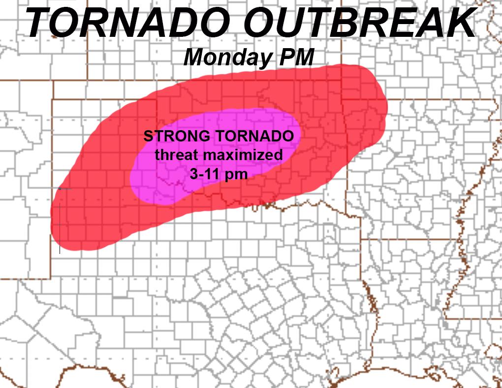
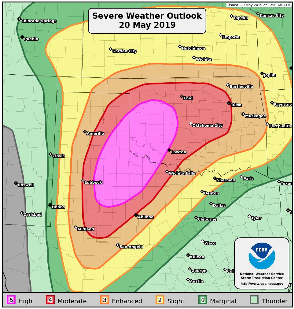
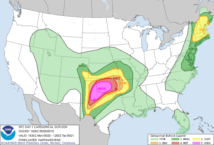
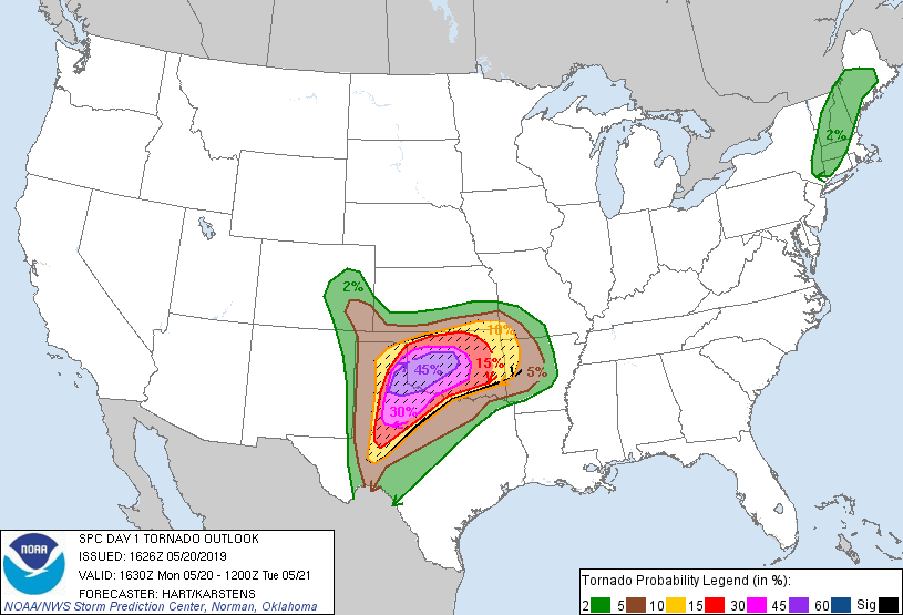
SPC mit seltenem High Risk:
https://www.spc.noaa.gov/products/outlo ... _1200.html
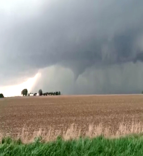
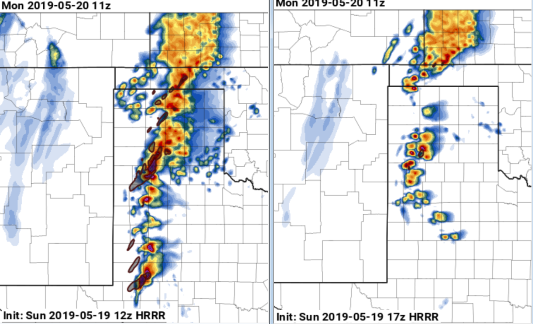
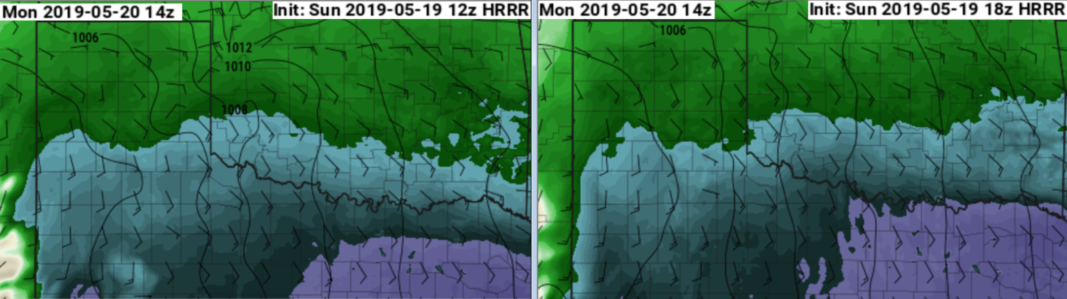
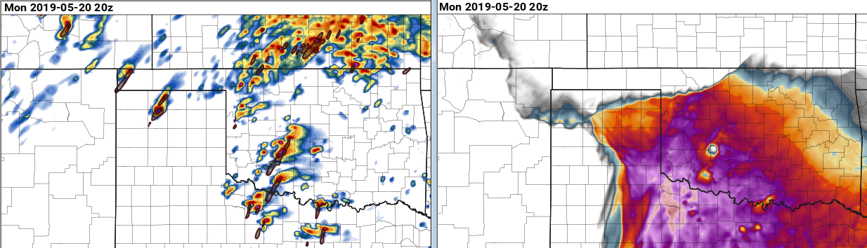
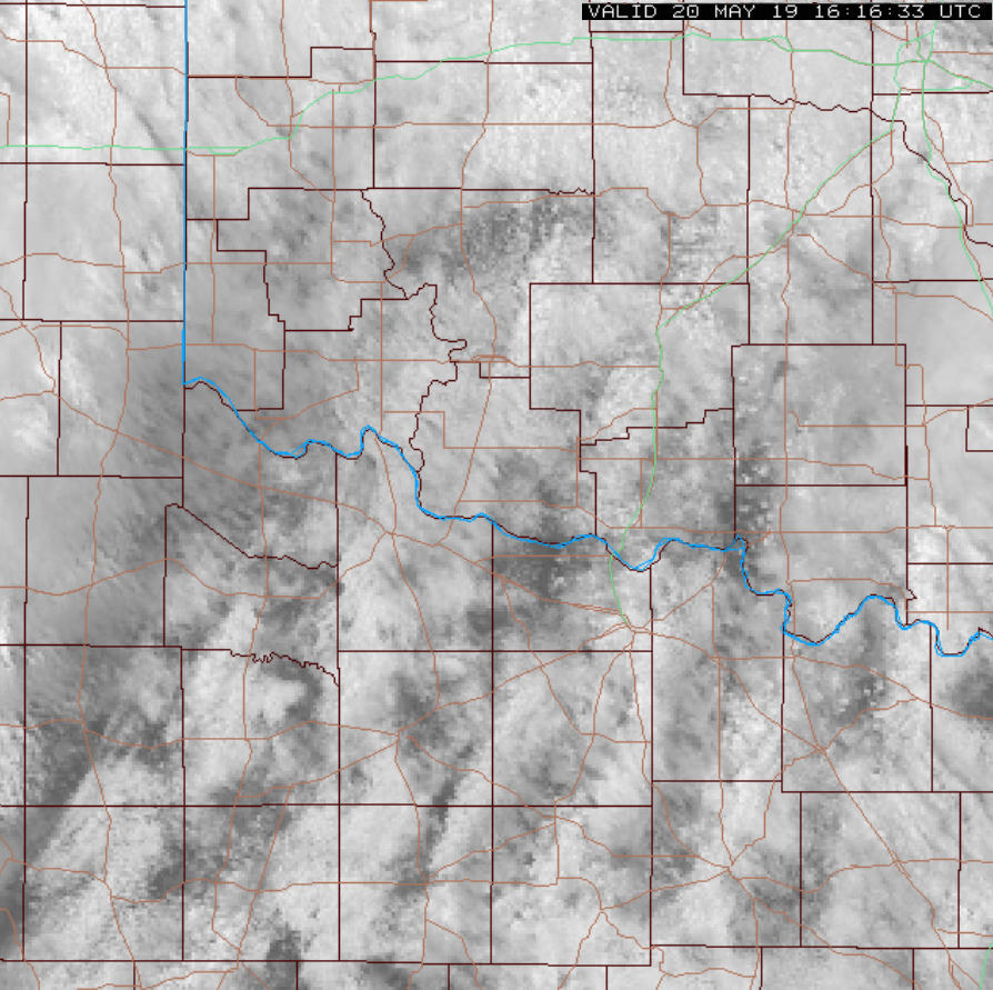
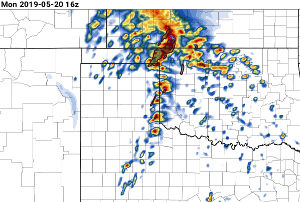
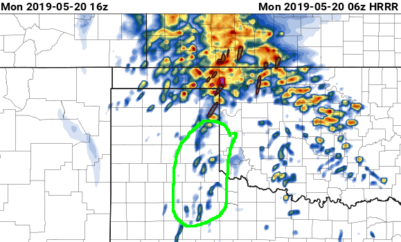
Mit den ersten Tornados ist ab 15Z zu rechnen im äusserten SW von Oklahoma entlang der nach Norden vorstossenden Warmfront. Davor Elevated Gewitter mit Hagel nördlich der Warmfront.
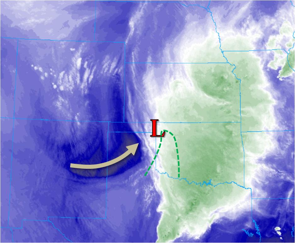
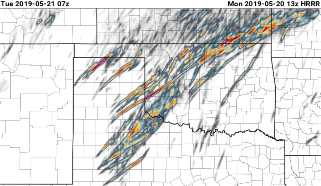
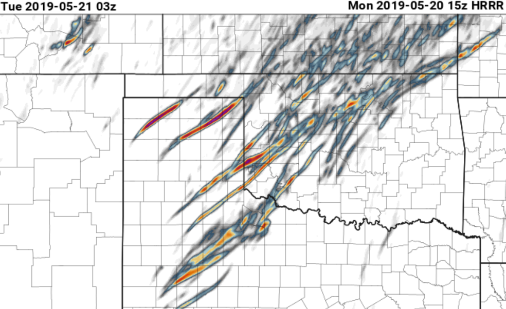
06Z Lauf mit etwas verzögerter Auslöse:
Quelle:
https://www.pivotalweather.com/model.ph ... &dpdt=&mc=
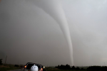
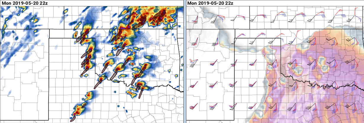
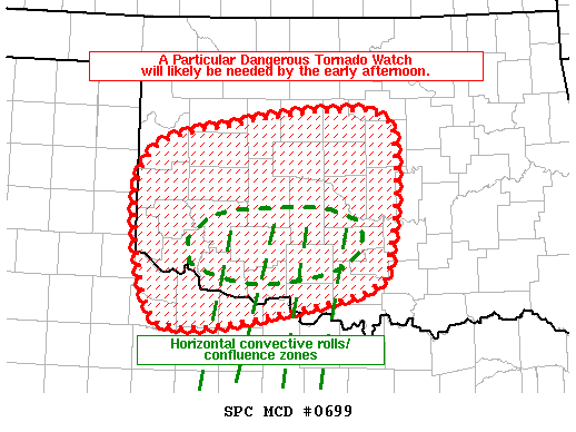
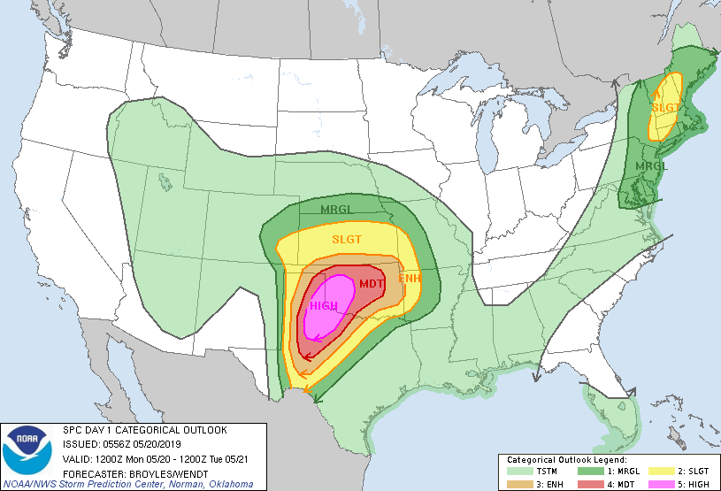
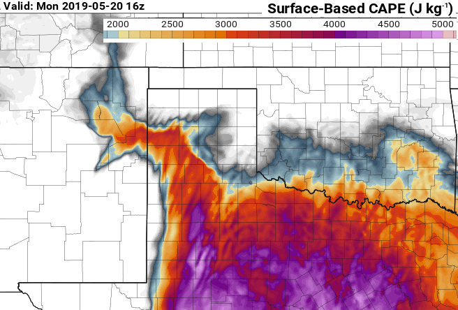
Gemäss SPC wurde das High Risk ausgegeben für die Gewitter die sich an der Dryline entwickeln ab etwa 20Z.

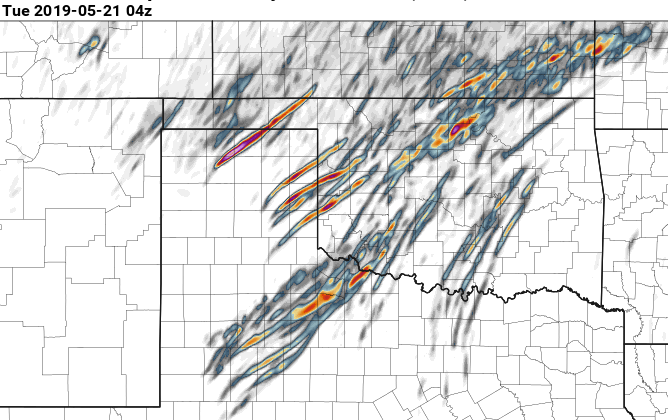
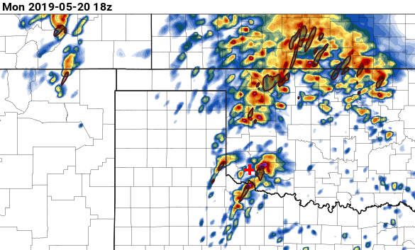
The second round of severe storms is expected to start during the
late afternoon as repeat initiation takes place in west Texas. Rapid
supercell formation is forecast along the I-27 corridor from the
vicinity of Lubbock northward to just south of Amarillo. A cluster
of tornadic supercells is then forecast to move northeastward into
northwest Texas and the southeastern Texas Panhandle during the
early evening. Additional tornadic supercells are forecast to
rapidly develop in southwest Oklahoma and move northeastward into
west-central Oklahoma. At that time, the strengthening low-level jet
will couple with a highly progressive and seasonably strong
mid-level jet, making conditions favorable for long-track strong
tornadoes and possibly violent tornadoes.
The greatest threat for long-track tornadoes will exist along the
corridor from near Lubbock northeastward to Childress, Altus,
Lawton, Clinton to just west of the Oklahoma City and Enid
vicinities. After considerable deliberation, a High risk will be
issued for parts of west Texas, the southeastern Texas Panhandle
into western Oklahoma.
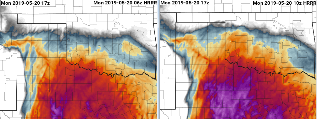
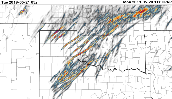
Mein Chasing Ausgangspunkt wäre Altus OK ab 16Z für die erste Runde der Gewitter. Diese dann entlang der I44 Richtung Oklahoma City chasen. Danach je nach Möglichkeit/Entwicklung zurück Richtung Dryline. (HRRR 07Z Lauf)
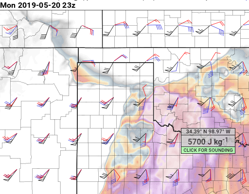
Was mit an der Dryline nicht gefällt, ist die nicht so grosse Richtungsänderung im Wind zwischen Boden und 850 hPa.
Gruss
Bernhard