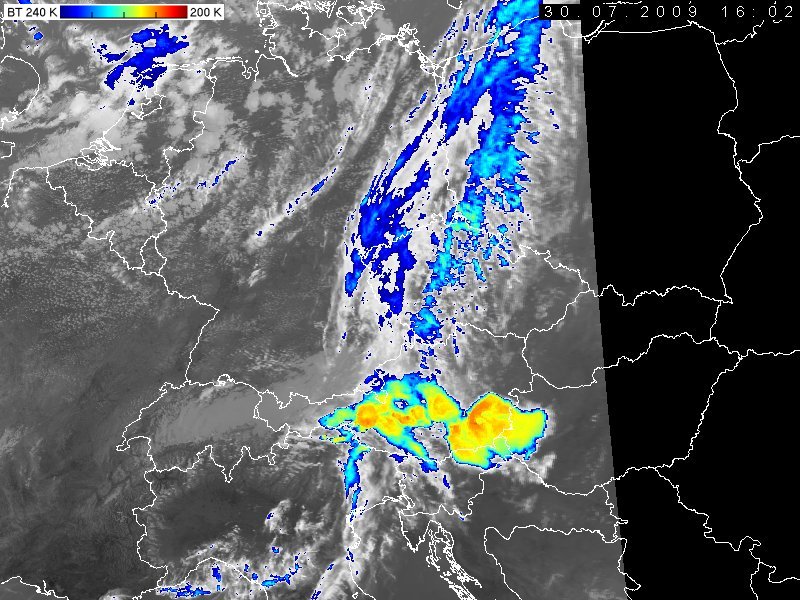
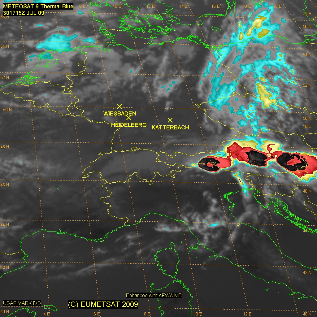
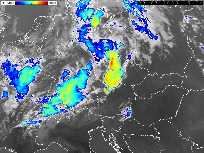
Cold Ring-Shape, Cold U/V-Shape, Enhanced-V with strong storms
Verfasst: Mo 15. Sep 2008, 13:25
Weitere Hintergrundinfos und Fallbeispiele zu Schwergewittern mit einem Cold Ring-Shape (auch Doughnut-Shape), Cold U- oder Cold V-Shape (Enhanced-V) im IR-Satellitenbild:
http://oiswww.eumetsat.org/WEBOPS/iotm/ ... ction.html
http://oiswww.eumetsat.org/WEBOPS/iotm/ ... ction.html
http://oiswww.eumetsat.org/WEBOPS/iotm/ ... ction.html
http://oiswww.eumetsat.org/WEBOPS/iotm/ ... ction.html
http://oiswww.eumetsat.org/WEBOPS/iotm/ ... ction.html
http://oiswww.eumetsat.org/WEBOPS/iotm/ ... storm.html
http://convection.satreponline.org/case ... /index.php
http://convection.satreponline.org/ppt/ ... 071116.ppt
http://ams.confex.com/ams/pdfpapers/24983.pdf
Die Ring-, U- und V-Formen stellen einen Temperaturunterschied der Cloud Tops dar, welcher durch die starke Penetration einer mächtigen Gewitterzelle (bzw. dessen Updrafts) in die untere Stratosphäre zustande kommt.
Aktuelles Beispiel:
http://www.sturmforum.ch/showthread.php?id=5938
Gruss Chrigi
http://oiswww.eumetsat.org/WEBOPS/iotm/ ... ction.html
http://oiswww.eumetsat.org/WEBOPS/iotm/ ... ction.html
http://oiswww.eumetsat.org/WEBOPS/iotm/ ... ction.html
http://oiswww.eumetsat.org/WEBOPS/iotm/ ... ction.html
http://oiswww.eumetsat.org/WEBOPS/iotm/ ... ction.html
http://oiswww.eumetsat.org/WEBOPS/iotm/ ... storm.html
http://convection.satreponline.org/case ... /index.php
http://convection.satreponline.org/ppt/ ... 071116.ppt
http://ams.confex.com/ams/pdfpapers/24983.pdf
Die Ring-, U- und V-Formen stellen einen Temperaturunterschied der Cloud Tops dar, welcher durch die starke Penetration einer mächtigen Gewitterzelle (bzw. dessen Updrafts) in die untere Stratosphäre zustande kommt.
Aktuelles Beispiel:
http://www.sturmforum.ch/showthread.php?id=5938
Gruss Chrigi