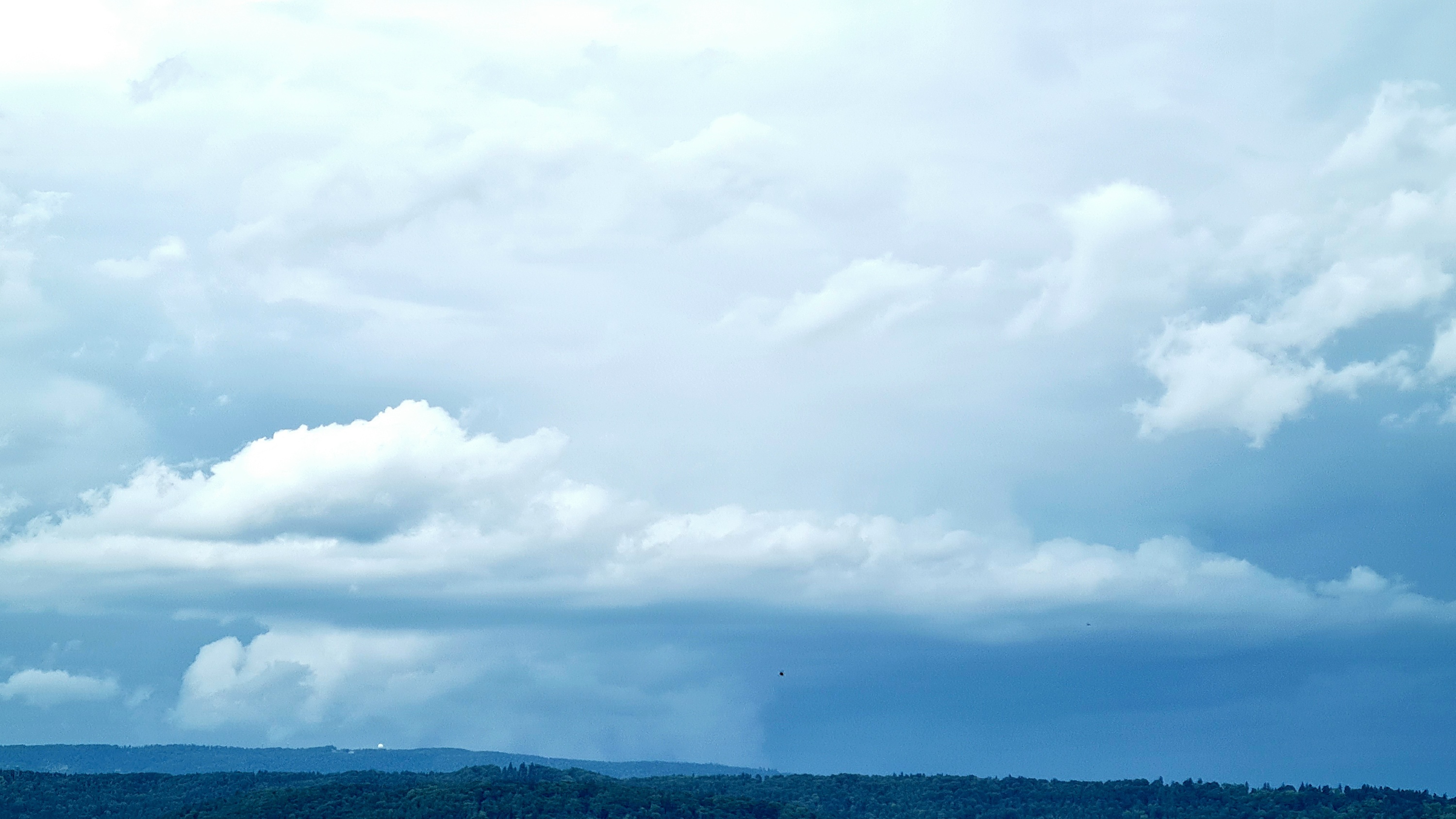
Eine Mischung aus diesem Gewitter-Thread (Datum allenfalls anpassen?) und dem (Alp-)Träume-Thread: Der aktuelle ICON-Lauf macht einen auf Bow-Echo morgen Mittwochnachmittag
Dann hoffen wir mal dass es nicht gleich so ruppig wird...
Gruss
Martin
In Zusammenarbeit mit meteoradar

Werbung

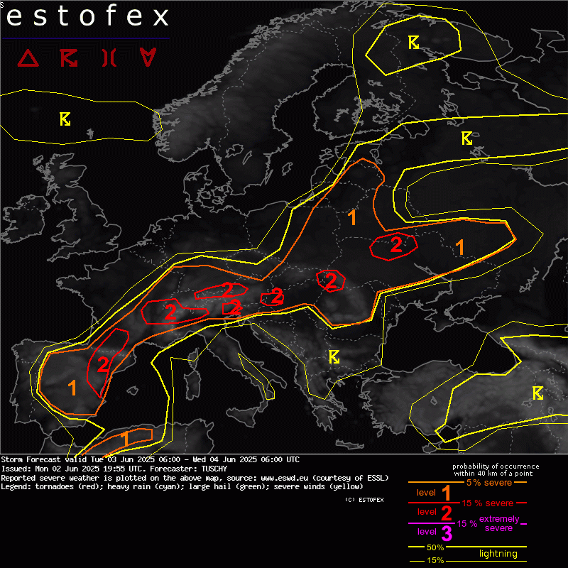
Mittwoch, 04.06.2025... S-CNTRL / E France, S Germany into Switzerland, Austria and N Italy ...
Sliding the boundary E towards France, we see a broad belt of 800-1500 J/kg MUCAPE overlapping with 15 m/s DLS and 0-3 km shear in the 10-15 m/s range. Weak ridging aloft keeps CI in check until noon/early afternoon before a passing weak wave and diabatic heating/the orography itself cause scattered CI. Most likely areas for CI reside along the Pyrenees N into SW France but also along the Massif Central E towards Switzerland and far NW Italy.
WAA along/S of the front enlarges hodographs, which show better LL curvature especially towards E-CNTRL France but also over far NW Italy (forced by the orography). CAPE/shear space supports numerous multicells and a few long-tracked supercells. Diffuse background forcing should assist in more discrete CI with a mix of classic to HP supercells as upper winds abate. Expect large to isolated very large hail, heavy rain and strong to severe gusts the main risk but modest 0-3 km CAPE, LCLs around 500-700 m and slightly enhanced LL shear along the front itself also indicate an isolated tornado risk, especially towards E-CNTRL France into far W Switzerland.
Towards NE Switzerland into Austria and far S Germany, CAPE shear space resembles the parameters further W, although CAPE remains a bit less bullish. ICON however increases 0-3 km shear into the 20 m/s range from Switzerland into S Germany, which would enlarge the lower parts of the hodograph, offering lots of strong SR inflow, with ICON pushing into the 30 kt 0-2 km SR inflow range. Lots of shear for sure for a mix of multicells, bowing segments and a few supercells with all kind of hazards possible including large hail, severe gusts and heavy rain but also an isolated tornado event. We added this area into a level 2 for the chance of a few long-trakced cells with all kind of hazards including hail larger 5 cm in diameter.
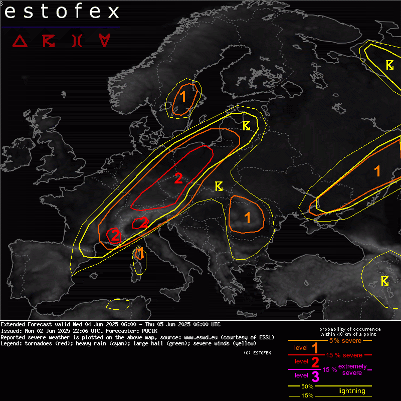
... NE Switzerland through SE/E Germany, NW Austria, Czechia into Poland ...
A wide belt with favourable conditions for (extremely) severe storms will exist in the region, featuring MLCAPE of 1500 to 3000 J/kg in combination with 0-6 km bulk shear of 20 to 30 m/s. The highest conditional threat of severe weather, concerning the CAPE-shear overlap, will exist from NE Switzerland through S Germany and NW Austria into SW Czechia. Here, fat CAPE profiles are simulated within and at the edge of a plume of steep lapse rates generated in the wake of the Alps. At first, high CAPE areas will be capped, but the approach of the front and a short-wave through from southwest will remove the CIN and the drier layer. The first storms will develop along the stalling cold front, the main round will be tied to the passage of the short-wave, E-ward surge of the cold front and storms spreading from the Alps over the lowlands.


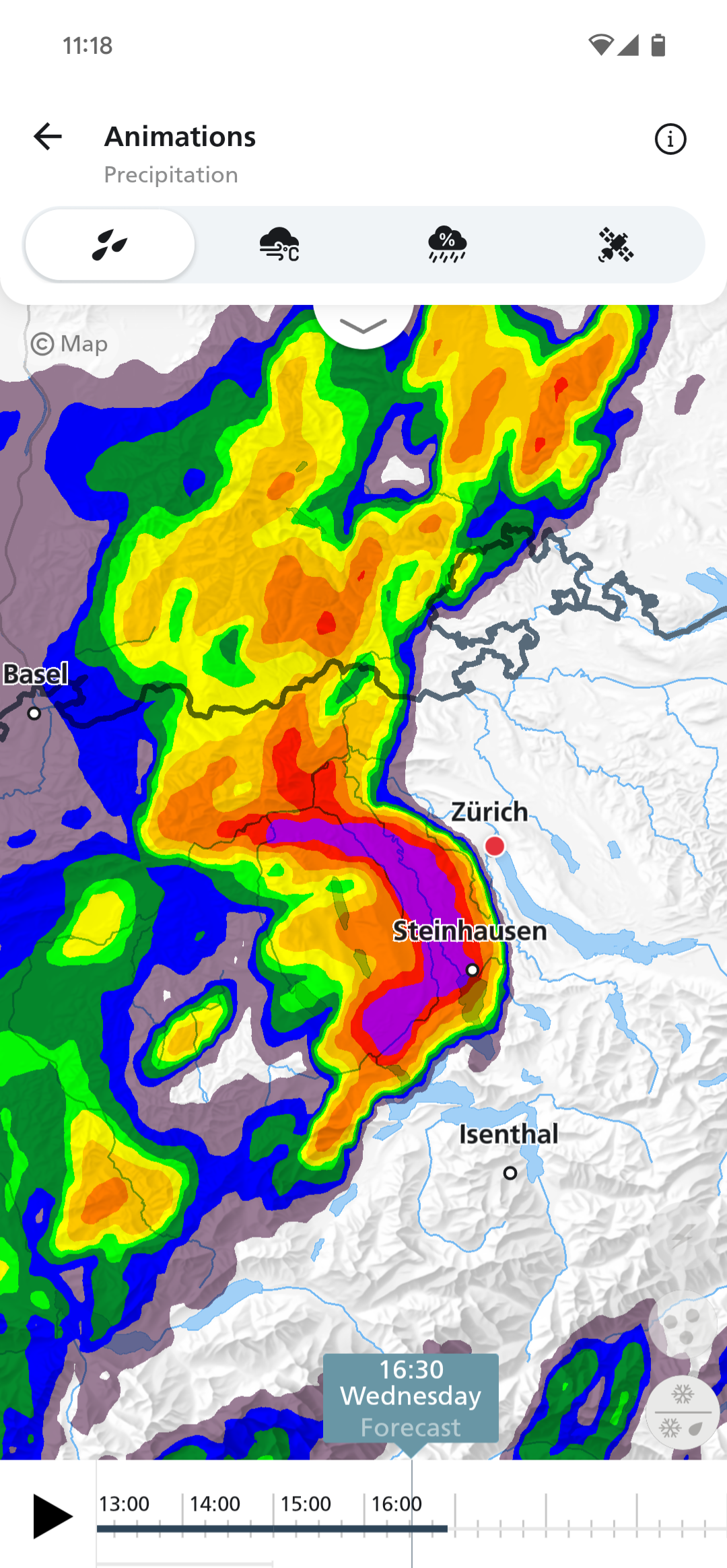
Ja dank obendata kann man das jetzt endlich nachprüfen. Es waren in der Spitze 13 mm in 10 Minuten und 28,2 mm von 13:40 Uhr bis 14:40 Uhr.Marco (Oberfrick) hat geschrieben: ↑Di 3. Jun 2025, 13:40 Hallo
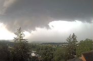
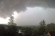
In Basel entleert sich gerade eine schöne Wasserbombe. Viel Regen paar Rumpler und kaum Wind.
Sogar kleiner Hagel ist dabei, aber die Niderschlagrate ist extrem.

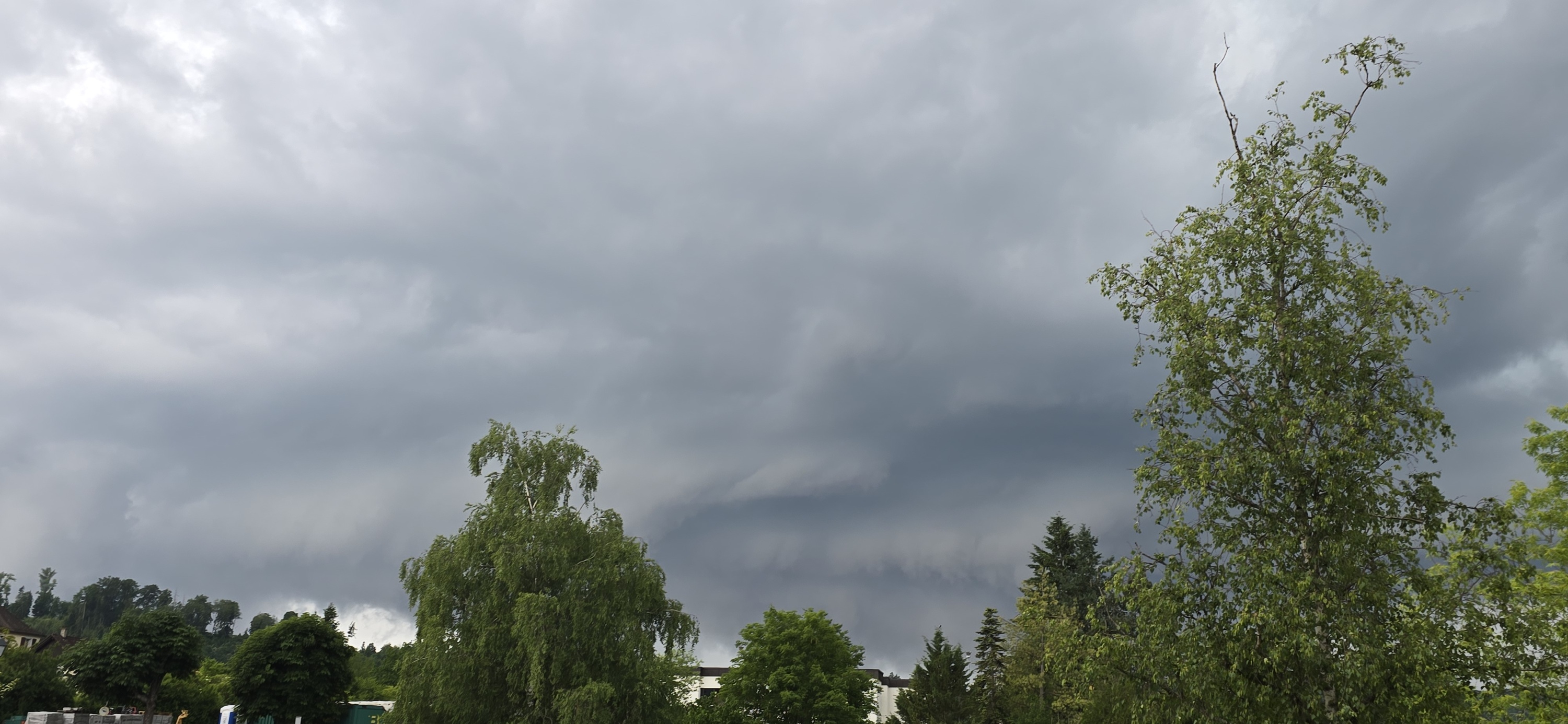
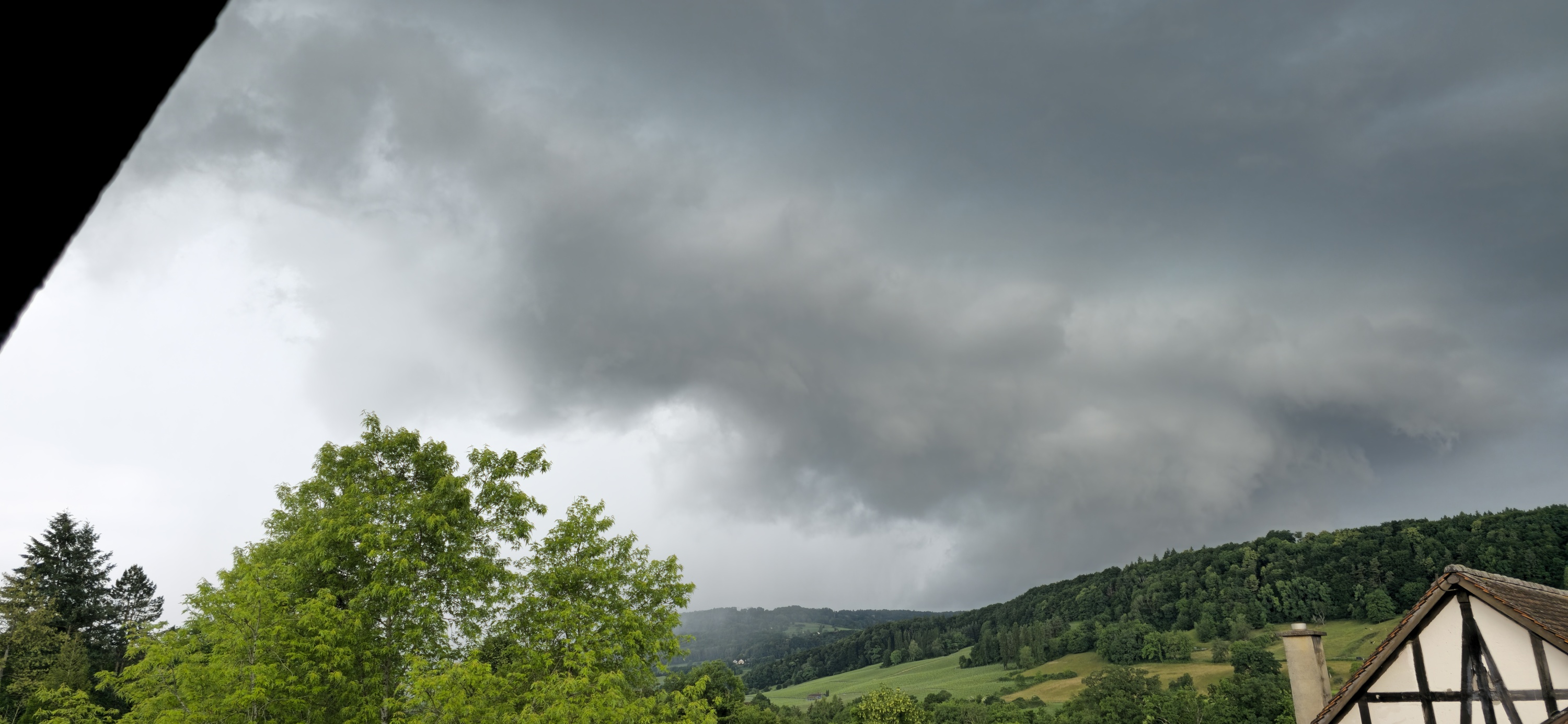
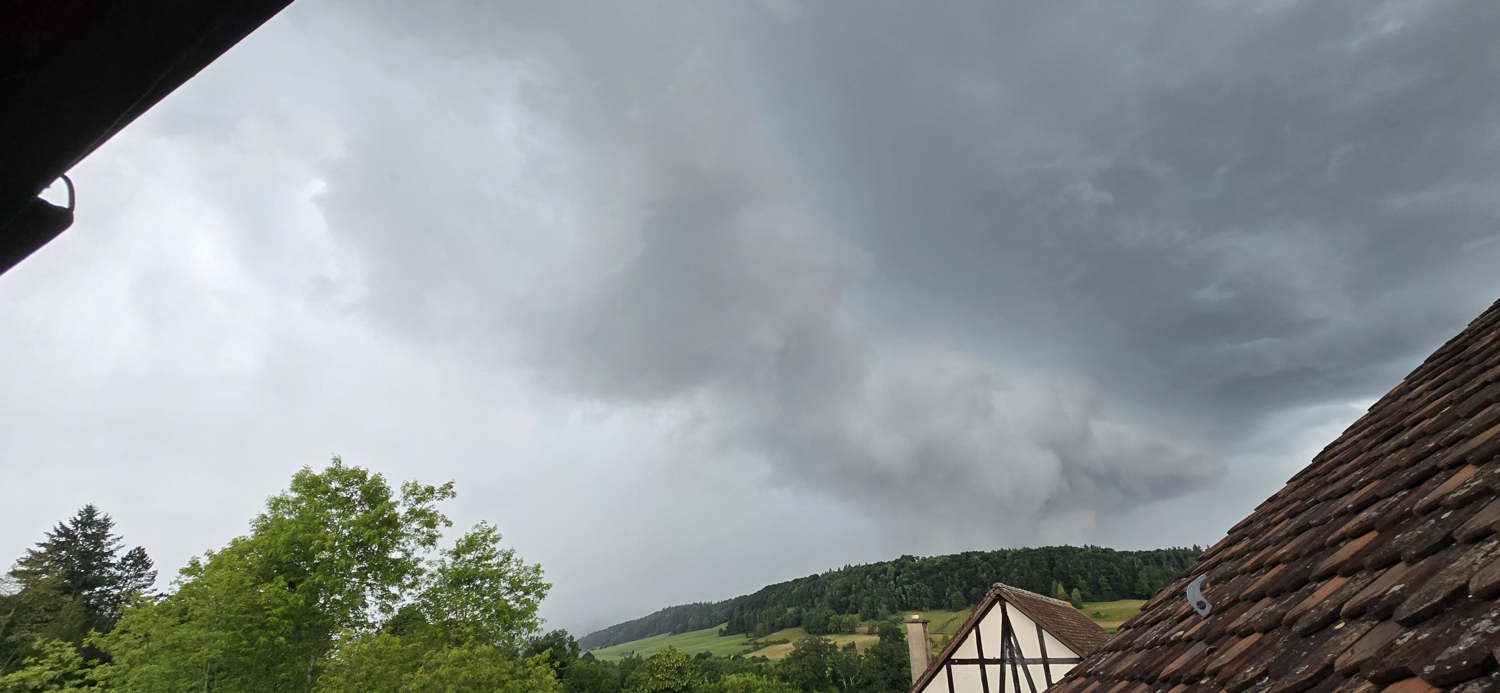
War bei mir nicht wirklich heftig, der Regen war eher gischtartig, aber kam fast wagrecht mit der Böenfront, Die war aber sehr ansehlich. So viel Donner wie Blitze auf den Radar waren, gabs irgendwie gar nicht. Ich hab keinen einzigen gesehen(vielleicht die Kameras mehr), wohl alles Wolkenblitze. Gefühlt 5 min Gewitterchen und das wars....
Werbung