@ Grafur Thalwil/BernCyrill hat geschrieben: Vermutlich liegt aber stellenweise ein Level 2 durchaus drin.
Gruss Cyrill
Danke für's posten. Offenbar habe ich nicht zuviel versprochen.
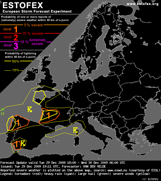
Hier noch den Estofex-Text:
Storm Forecast
Valid: Tue 29 Dec 2009 06:00 to Wed 30 Dec 2009 06:00 UTC
Issued: Tue 29 Dec 2009 05:21
Forecaster: VAN DER VELDE
...SW Iberian Peninsula...
Destabilization is forecast so that by the time the cold front reaches Portugal several hundred J/kg CAPE should be present. At the same time, EL temperatures are forecast to be relatively warm and the large PW content combined with high saturation (PW-sat. deficit below 300 hPa of 35 kg/m²) indicate an environment of high precipitation efficiency. Storms may organize along a regenerating line which at times trains slowly through the level 2 area, which has the highest chance of excessive precipitation. But storm cell speed itself should be fast in the strong flow, more than 25 m/s, and 1-3 km AGL mean winds can reach up to 75 kts (>35 m/s) over central Spain. So, severe gusts are possible, possibly from bow echo line segments, wherever convection can occur - GFS suggests even central Spain has at least a small amount of CAPE at 15Z. In the same area, DLS can reach very high values around 40 m/s 0-6 km, SREH 300-400 m²/s² and LLS 15-20 m/s. An isolated tornado may occur.
...NW Iberian Peninsula...
Around 00Z a new disturbance with unstable air will come onshore, backed by a mid level PV anomaly. Strong deep layer shear of 30-45 m/s with a steep gradient will overlap the unstable air. LLS is >17 m/s. Tornadoes and severe gusts could occur.
Die Windscherungsverhältnisse sind sehr gut, doch man gibt sich verhalten in der Vorhersage von Tornados ("may occur", "could occur").
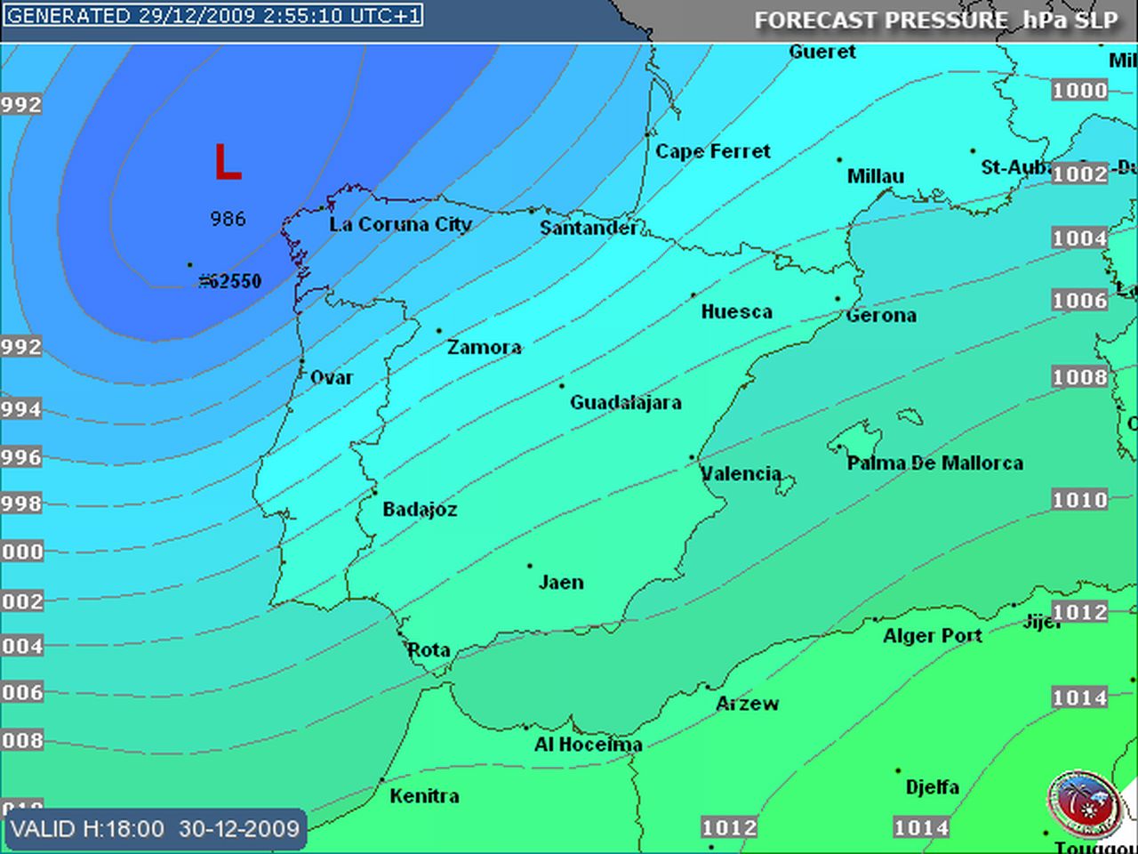
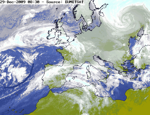
Die KF ist noch etwa 400 km von der Küste Portugals entfernt:
Bei einer Geschwindigkeit von 25 m/s, dürfte es am Nachmittag 14z/15z langsam spannend werden.
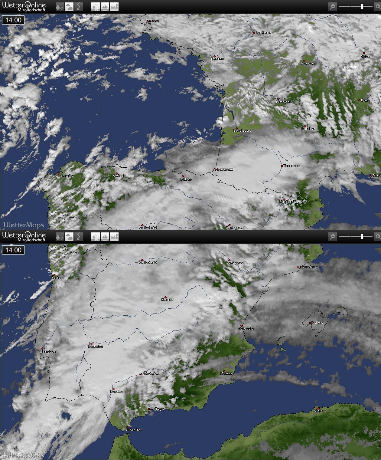
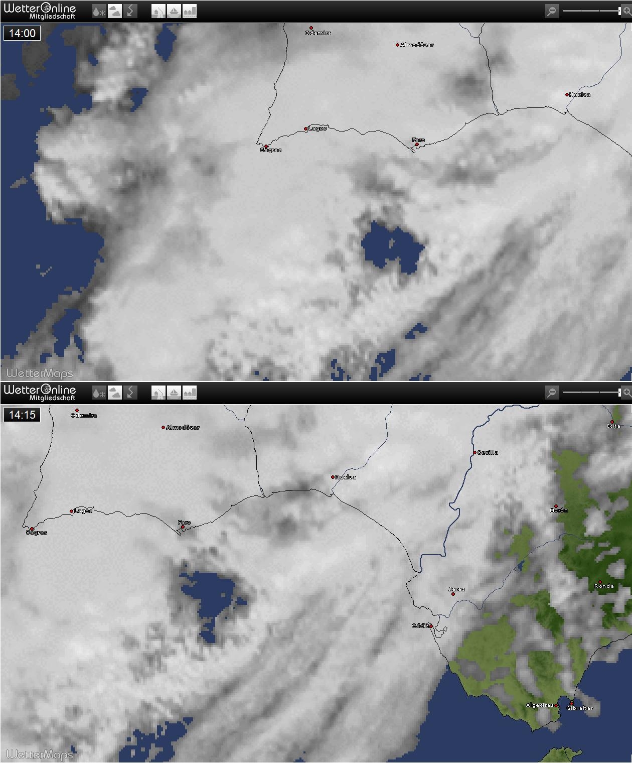
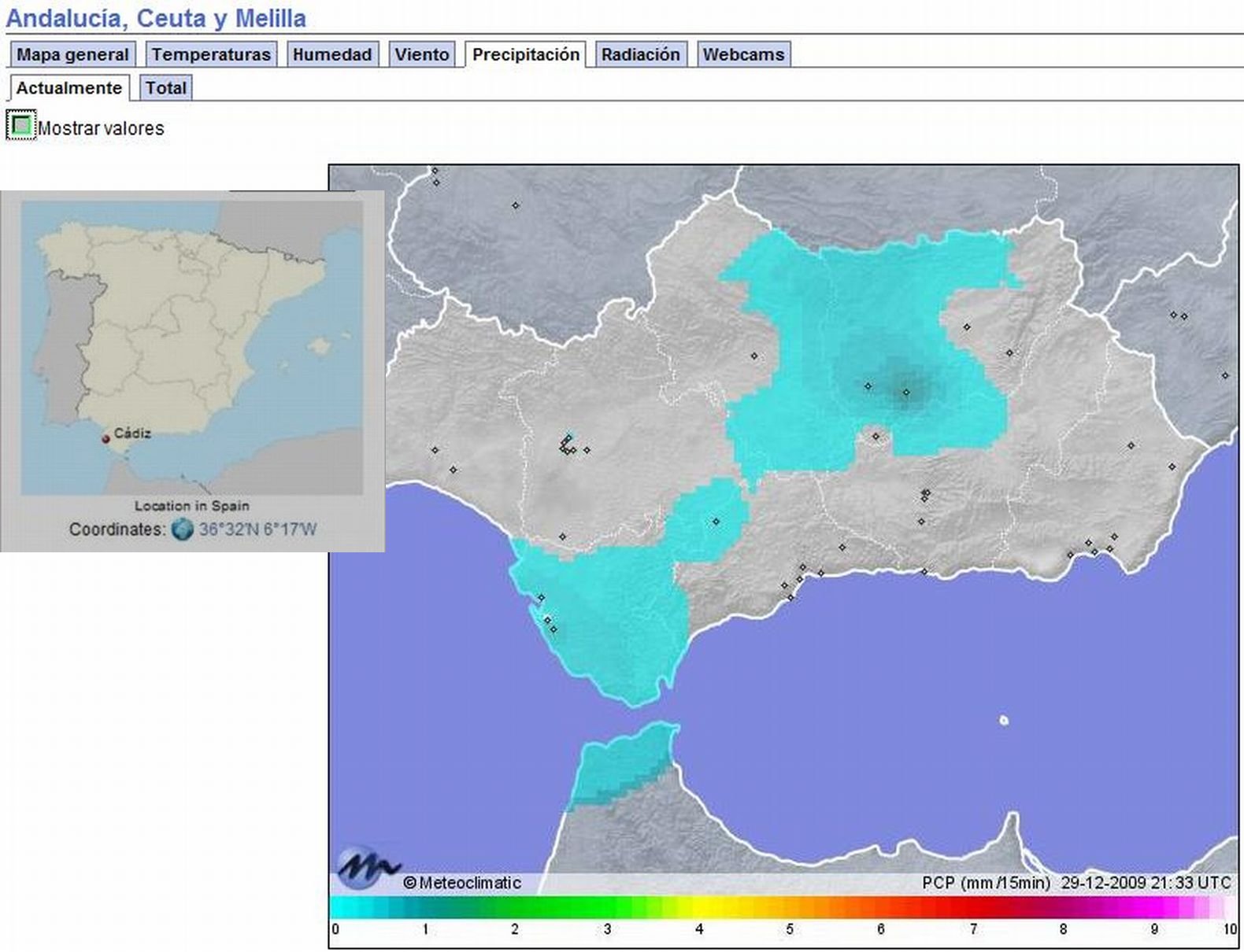
Jedenfalls sieht man auf dem Web-Cam-Bild von Tavira (an der Grenze zu Spanien), eine Stadt die im Level 2-Gebiet liegt, nur stratiforme Bewölkung. Doch gem. Sat-Bild dürfte die Wolkendecke in wenigen Stunden aufreissen, dann heizt die Sonne ein wenig, bis die Front eintrifft:
Webcam Tavira: http://www.tavira.cienciaviva.pt/webcam/
Webcam Rio Gilao in Tavira: http://www.verdeland.com/live-webcam-ta ... tugal.html
Schöne braune Brühe (und Treibholz), die da den Fluss runter kommt.
@ Wolfi1985 / 19Gino57
Die Situation ist doch etwas / sehr schwierig einzuschätzen; und selbst von Porto aus sinds mind. 3-4 Std. mit dem (Miet-)Auto.
Ich glaube, dass Tuschy bei Estofex für die Schweiz (Level 1) das Ganze etwas gar optimistisch sieht. Man darf den Einfluss des Atlantiktiefs nicht unterschätzen; d.h. am östlichen Rand an der Grenze zur Schweiz könnte durchaus statt der gewünschten SW-Strömung eine SSW- /S-Strömung eintreten, was Föhn bedeuten würde.....und den Rest kennen wir ja
Gruss Cyrill